• KGS/USD = 0.01144 0%
  • KZT/USD = 0.00194 -0%
  • TJS/USD = 0.10834 -0.09%
  • UZS/USD = 0.00008 0%
  • TMT/USD = 0.28490 0%
  • KGS/USD = 0.01144 0%
  • KZT/USD = 0.00194 -0%
  • TJS/USD = 0.10834 -0.09%
  • UZS/USD = 0.00008 0%
  • TMT/USD = 0.28490 0%
  • KGS/USD = 0.01144 0%
  • KZT/USD = 0.00194 -0%
  • TJS/USD = 0.10834 -0.09%
  • UZS/USD = 0.00008 0%
  • TMT/USD = 0.28490 0%
  • KGS/USD = 0.01144 0%
  • KZT/USD = 0.00194 -0%
  • TJS/USD = 0.10834 -0.09%
  • UZS/USD = 0.00008 0%
  • TMT/USD = 0.28490 0%
  • KGS/USD = 0.01144 0%
  • KZT/USD = 0.00194 -0%
  • TJS/USD = 0.10834 -0.09%
  • UZS/USD = 0.00008 0%
  • TMT/USD = 0.28490 0%
  • KGS/USD = 0.01144 0%
  • KZT/USD = 0.00194 -0%
  • TJS/USD = 0.10834 -0.09%
  • UZS/USD = 0.00008 0%
  • TMT/USD = 0.28490 0%
  • KGS/USD = 0.01144 0%
  • KZT/USD = 0.00194 -0%
  • TJS/USD = 0.10834 -0.09%
  • UZS/USD = 0.00008 0%
  • TMT/USD = 0.28490 0%
  • KGS/USD = 0.01144 0%
  • KZT/USD = 0.00194 -0%
  • TJS/USD = 0.10834 -0.09%
  • UZS/USD = 0.00008 0%
  • TMT/USD = 0.28490 0%
10 December 2025

Viewing results 1 - 6 of 4

New FAO Report Ranks Tajikistan Among World’s Most At-Risk Countries for Land Degradation

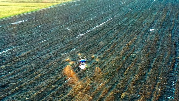
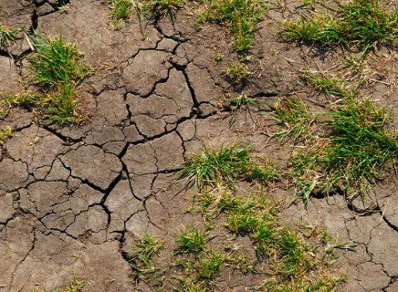
Tajikistan is among the countries most vulnerable to land degradation, according to a new report from the Food and Agriculture Organization of the United Nations (FAO). The findings point to alarming environmental and socio-economic risks for a country where agriculture remains the primary source of employment. The FAO attributes Tajikistan's vulnerability to a combination of small landholdings and intense pressure on soil resources. The country has more than 1 million rural households, including approximately 181,000 dekhkan farms. The average landholding is just 0.2 hectares, with a median size of 0.1 hectares, meaning half of all farmers operate on micro-plots. Challenges to Sustainable Agricultural Growth Under these conditions, expanding agricultural production is not feasible through increased acreage. Instead, growth depends on improving soil quality, upgrading irrigation systems, ensuring stable water access, and adopting modern technologies. These factors now define the boundaries of Tajikistan's agricultural development. According to the FAO, land degradation has affected 3.2 billion people globally, nearly 40% of the world's population. In some regions, agricultural yields have already declined by at least 10%. In Tajikistan, the stakes are especially high. The country has limited arable land, and its farming sector relies heavily on glacial meltwater and consistent irrigation. Climate risks are intensifying faster here than in many neighboring states. Extent and Impact of Land Degradation International experts estimate that nearly 70% of Tajikistan’s arable land is already degraded, with 10% of the population living in affected areas. The main drivers are erosion, salinization, and nutrient depletion, which collectively undermine soil productivity. These environmental pressures reduce rural incomes, increase reliance on external resources such as fertilizers, and contribute to forced migration, exacerbating social and economic vulnerabilities across the country.

East Kazakhstan Researchers Use AI and Drones to Boost Soil and Crop Management

Researchers at Sarsen Amanzholov University in Ust-Kamenogorsk, East Kazakhstan, have developed a digital system that integrates drone imagery with artificial intelligence (AI) to assess soil quality and crop health with high precision. The system enables farmers to monitor soil and plant conditions in ways previously inaccessible. Drones equipped with multispectral cameras capture images across five spectral bands: red, blue, green, near-infrared, and mid-infrared. “This approach makes it possible to ‘see’ what is invisible to the human eye, soil moisture levels, chlorophyll content, early signs of plant disease, or land degradation,” said Almasbek Maulit, a researcher at Sarsen Amanzholov University. “AI algorithms analyze the images, differentiate between crops and weeds, identify patterns of spread, and even generate automatic maps of infected areas. This enables farmers to take targeted action from local treatment of problem zones to adjusting crop rotation or cultivation methods.” The system offers several key benefits: Optimized use of fertilizers and plant protection products, reducing costs Early detection of problems, minimizing crop losses Improved profitability through better sowing and crop management strategies Reliable land quality assessments for investors and state authorities The project is part of Kazakhstan’s broader strategy to integrate high-tech solutions into agriculture, a sector that remains a cornerstone of the national economy. Earlier this year, The Times of Central Asia reported that engineers in Karaganda unveiled prototypes of drones designed for public safety applications. By merging AI with drone-based imaging, scientists in East Kazakhstan are helping to position the country’s agribusiness sector for smarter, more sustainable practices and long-term growth.