“Acid clouds” from Iran? Kazakhstan and Uzbekistan Weather Agencies Say There is No Threat to Central Asia
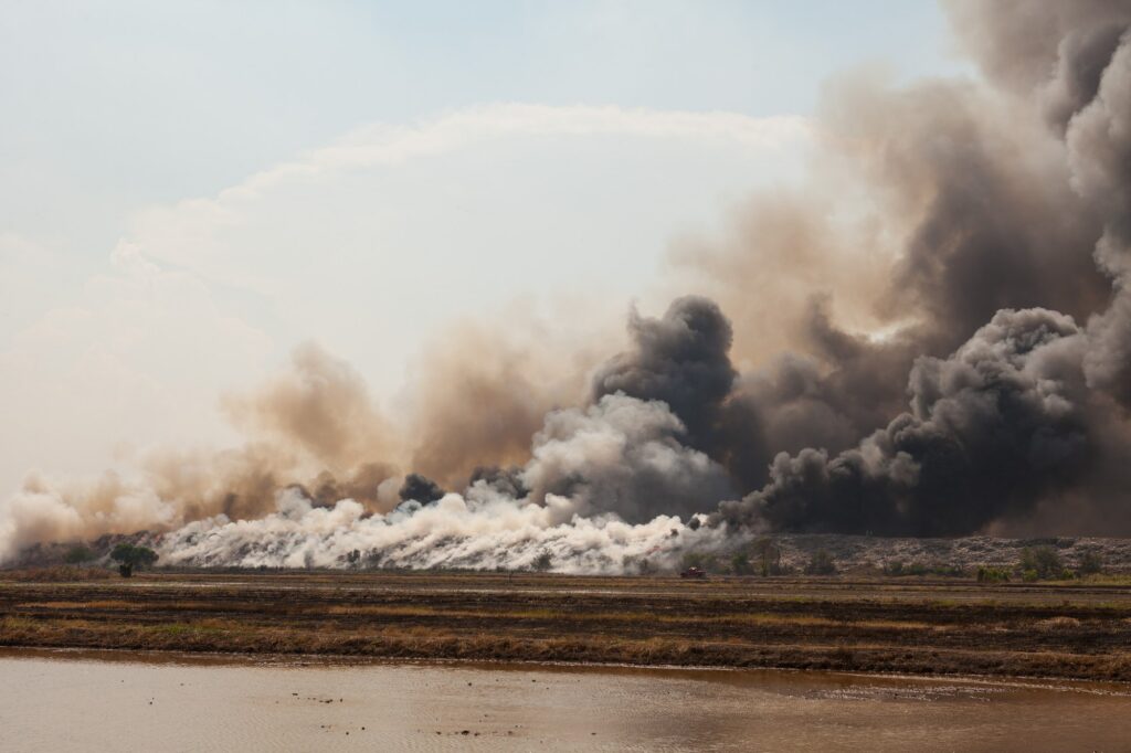
Social media has been flooded with claims that a toxic cloud could drift from Iran toward Central Asia following strikes on oil facilities. However, the meteorological services of Kazakhstan and Uzbekistan say those fears are not supported by scientific data. In recent days, posts online have warned of so-called “acid clouds” allegedly forming over Iran after attacks on oil depots and other energy infrastructure. Some of these posts claimed the pollution could be carried by atmospheric currents toward Turkmenistan, Uzbekistan, Kazakhstan, and China. Others cited reports of “black rain” in Tehran and elevated concentrations of sulphur dioxide, nitrogen oxides, and soot. Iranian authorities and international reporting have documented severe local air pollution risks in and around Tehran after the strikes. The Iranian Red Crescent Society warned residents that rainfall following the explosions could be acidic and hazardous to health. Experts said the pollution could irritate the skin, eyes, and lungs and contaminate soil and water near the affected areas. Kazhydromet, Kazakhstan’s national weather service, said reports that “acid clouds” from Iran could reach Central Asia are not confirmed by scientific data or observation results. The agency explained that acid precipitation typically forms near the source of emissions and that the concentration of pollutants decreases significantly over long distances due to natural atmospheric processes. Monitoring data, it said, show no signs of such pollution moving toward Kazakhstan or other Central Asian countries. Uzbekistan’s hydrometeorological service, Uzhydromet, expressed a similar position. It said information circulating on social media about “acid clouds” reaching Central Asian countries has no scientific basis. According to the agency, dangerous concentrations of acid precipitation thousands of kilometres from the source are practically impossible, and current observations show no threat to Uzbekistan or neighbouring states. Experts note that large fires at oil facilities can release substantial amounts of harmful pollutants into the atmosphere. However, such risks are primarily local or regional near the source. By the time emissions travel very long distances, atmospheric dispersion and deposition typically reduce concentrations sharply. As a result, the health concerns reported in Tehran do not support claims of a toxic cloud threatening Central Asia. Both Kazhydromet and Uzhydromet urged the public and media outlets to rely on official information and avoid spreading unverified reports.