• KZT/USD = 0.00215
  • TJS/USD = 0.10810
  • UZS/USD = 0.00008
  • TMT/USD = 0.29850
  • KZT/USD = 0.00215
  • TJS/USD = 0.10810
  • UZS/USD = 0.00008
  • TMT/USD = 0.29850
  • KZT/USD = 0.00215
  • TJS/USD = 0.10810
  • UZS/USD = 0.00008
  • TMT/USD = 0.29850
  • KZT/USD = 0.00215
  • TJS/USD = 0.10810
  • UZS/USD = 0.00008
  • TMT/USD = 0.29850
  • KZT/USD = 0.00215
  • TJS/USD = 0.10810
  • UZS/USD = 0.00008
  • TMT/USD = 0.29850
  • KZT/USD = 0.00215
  • TJS/USD = 0.10810
  • UZS/USD = 0.00008
  • TMT/USD = 0.29850
  • KZT/USD = 0.00215
  • TJS/USD = 0.10810
  • UZS/USD = 0.00008
  • TMT/USD = 0.29850
  • KZT/USD = 0.00215
  • TJS/USD = 0.10810
  • UZS/USD = 0.00008
  • TMT/USD = 0.29850
12 August 2026

Viewing results 1 - 6 of 8

Kyrgyzstan Links Record Heatwave to Accelerating Glacier Retreat

Kyrgyzstan's state weather agency, Kyrgyzhydromet, has warned that last month's record-breaking heatwave is the latest sign of climate change accelerating the retreat of the country's glaciers, threatening water supplies across Central Asia. The agency said the immediate heatwave was caused by regional atmospheric conditions, but its director, Daurbek Sakeyev, argued that the growing frequency of such extreme weather reflected a longer-term warming trend already affecting mountain ecosystems and water resources. Abnormally hot weather settled over Kyrgyzstan on July 14. Meteorologists attributed it to a combination of a summer thermal depression over Central Asia and a persistent area of high pressure in the upper atmosphere. The country saw consecutive days with temperatures exceeding 40°C. In Bishkek, the temperature reached 43.5°C on July 19, the highest July reading in the capital since observations began in 1936. Bishkek recorded no measurable rainfall during the month, while average daily temperatures on July 18 and 19 stood nearly 10°C above the seasonal norm. Record electricity demand prompted temporary supply restrictions in Bishkek and the surrounding Chuy Region, although a separate widespread outage on July 17 was attributed to the emergency disconnection of two 220-kilovolt transmission lines. Speaking after the heatwave had subsided, Sakeyev said spring was arriving earlier, summers were becoming hotter, and winters were bringing less precipitation, changes that were affecting the condition of the country’s glaciers. Earlier spring warming lengthens the annual melting season, while prolonged periods of extreme summer heat accelerate ice loss. Reduced winter snowfall also limits the accumulation of new ice and exposes darker glacier surfaces earlier, causing them to absorb more solar energy. According to Kyrgyzhydromet, Kyrgyzstan’s glaciers have lost around 16% of their total area over the past 70 years. Recent monitoring places the decline in the Talas Valley at 22%. Smaller, lower-altitude glaciers are particularly vulnerable, and scientists expect their number and area to decline substantially by 2050. Separately, Kyrgyzhydromet reported on July 30 that glacier area in the Issyk-Kul basin had declined by 33.7% over 70 to 90 years and by 23.1% over the most recent seven to ten years. The consequences extend beyond Kyrgyzstan. Tien Shan glaciers feed the Syr Darya, Chu, Talas, and Ili river systems, supplying water for millions of people, irrigation, and hydropower. Continued glacier retreat could alter seasonal flows and increase the risk of glacial lake outburst floods threatening mountain communities. Glacier retreat is one of Central Asia’s most significant long-term challenges. The region’s water security will depend on precipitation, seasonal snow cover, glacier loss, and governments’ ability to store and manage increasingly variable river flows.

Kyrgyzstan Records 348 Mudflows in Six Months, Highest Total in Decades

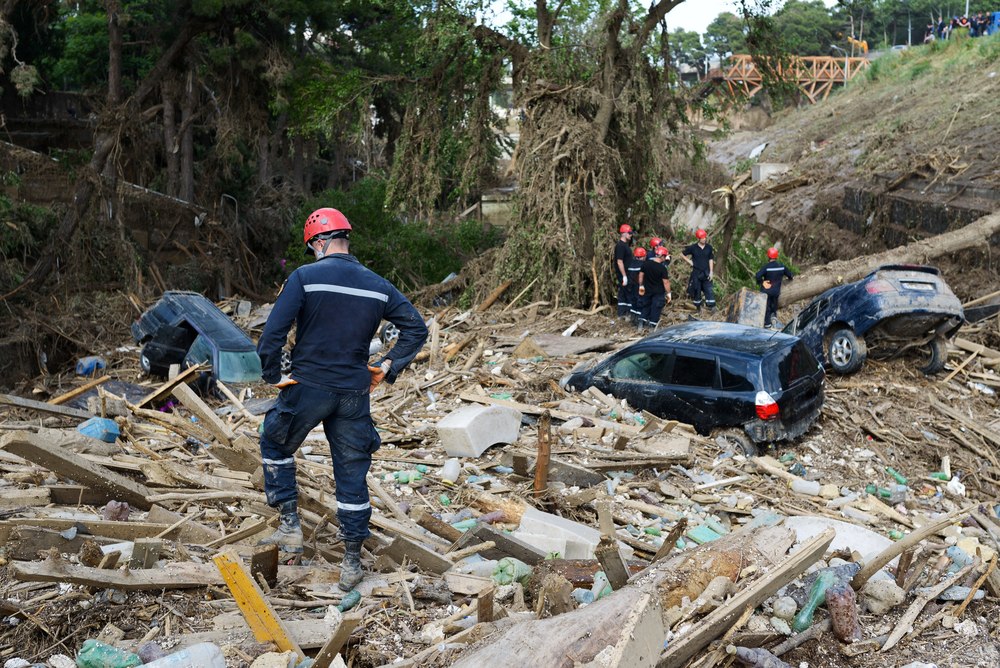
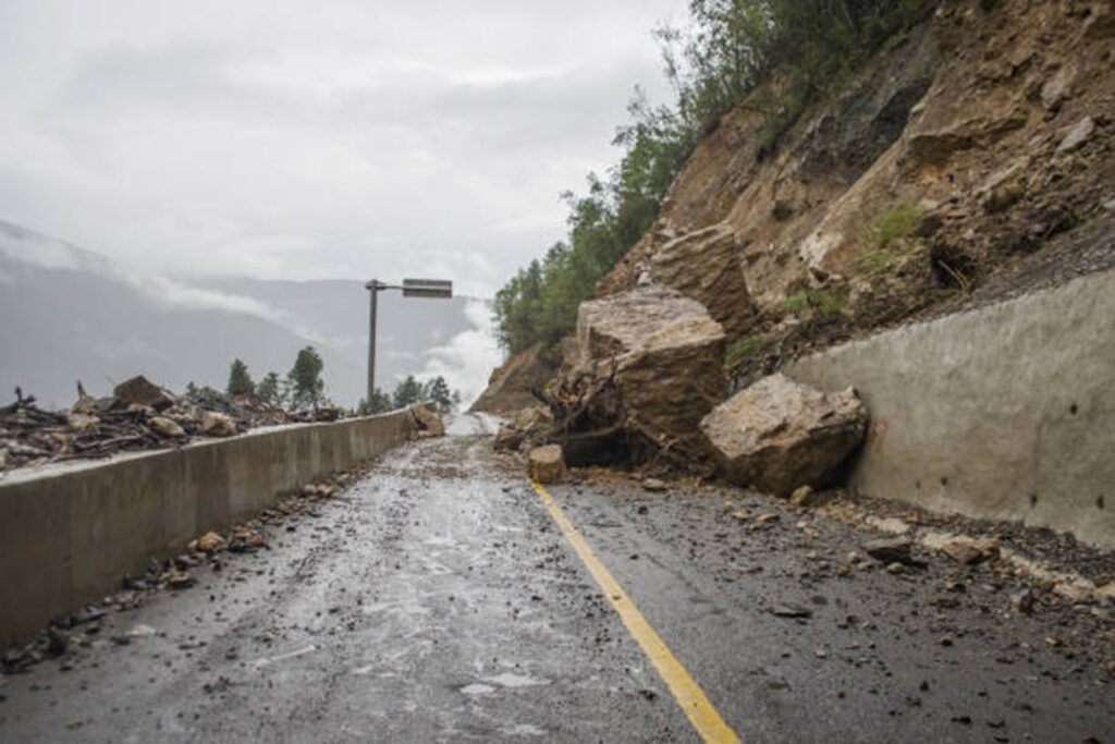
Kyrgyzstan recorded 348 mudflows during the first half of 2026, the highest number in 30 to 40 years, according to the Ministry of Emergency Situations and Kyrgyzhydromet. These violent torrents of water, mud, and boulders killed eight people and injured three. Roads, villages, and critical infrastructure are concentrated in narrow mountain valleys. Each new debris flow can therefore threaten lives and isolate entire communities. A Rapidly Escalating Season The damage extends beyond the human toll. Authorities evacuated 236 people from hazardous areas, while mudflows damaged 668 hectares of farmland. Preliminary estimates place economic losses at 399 million soms (approximately $4,560,000). The scale of the crisis became apparent well before mid-summer. By late June, Kyrgyzstan had already recorded more than 240 mudflows. The first-half total of 348 was almost five times the roughly 70 recorded during the same period of 2025. The deadliest incident occurred on the Osh-Alay highway, where a powerful mudflow swept a vehicle from the road, killing six people. The Ministry of Emergency Situations identifies Batken, Jalal-Abad, Osh, and Talas regions as the country’s most vulnerable areas, where mudflows repeatedly destroy roads, bridges, and residential buildings. Why the Risk Is Increasing Officials link the surge to several overlapping factors, including intense local downpours and earlier snow and glacier melt. Settlement expansion into hazardous valleys and a shortage of protective structures have increased exposure. Pasture degradation and forest loss add to the danger. Rising temperatures are also transforming the Tian Shan as glaciers retreat and new high-altitude lakes emerge. Kyrgyzhydromet estimates that the area of Kyrgyzstan’s glaciers has declined by about 16% in recent decades. As glaciers shrink, newly formed alpine lakes become more vulnerable to overflowing or bursting during intense rainfall or rapid snow and ice melt. Such outbursts can generate destructive debris flows. The threat extends beyond mudflows. Officials warn that warming will also increase the risks posed by glacial-lake outbursts, landslides, and rockfalls. Strengthening Defenses Despite the record number of mudflows, the death toll remains significantly lower than in 2024, when such disasters claimed 25 lives. The Ministry of Emergency Situations attributes the improvement to earlier warnings, more effective evacuations, and expanded preventive measures in high-risk areas. Kyrgyzstan is also expanding its use of forecasting technologies. KG Labs, working with international partners, is developing an AI model to forecast glacial lake outburst floods in the Tian Shan. The work draws on a digital catalogue of Kyrgyzstan’s glaciers and is exploring affordable sensors for remote mountain areas with intermittent internet access. The Ministry of Emergency Situations already uses a separate AI-powered system to monitor high-altitude lakes and issue warnings. The Season Is Far From Over The figure of 348 covers only the first six months. In Kyrgyzstan, the period of highest risk typically lasts until autumn, meaning that mountain communities and transport corridors remain vulnerable for several more months. The events of 2026 illustrate how rapidly natural hazards are evolving. Retreating glaciers, the formation of new alpine lakes, and increasingly intense rainfall are changing the country’s risk...

Kyrgyzstan’s Water Compensation Push Tests Central Asian Unity

Central Asia’s water diplomacy is entering a contentious phase. Kyrgyzstan, where much of the region’s runoff is formed, is reviving calls for economic compensation from downstream users. Kazakhstan and Uzbekistan have rejected the idea, saying current agreements do not provide for payments for transboundary river water. The dispute comes as the region tries to maintain annual water-allocation deals while adapting agriculture to worsening scarcity and climate pressure. Water has long tied together the region’s upstream and downstream states. The 2021 and 2022 clashes on the Kyrgyz-Tajik border showed how disputes over land, border infrastructure, roads, security posts, and water access can escalate when local tensions are not contained. Yet political will alone does not guarantee agreements between countries. The Central Asian republics cooperate on water issues through two interstate bodies. One is the International Fund for Saving the Aral Sea, established in 1993 by all five Central Asian republics. Kyrgyzstan suspended its participation in IFAS in 2016, and now attends the fund’s meetings as an observer. The second body is the Interstate Commission for Water Coordination, whose meetings are held once a quarter. At its 93rd meeting in Bukhara in early April, the commission confirmed limits for water withdrawal from transboundary rivers, following decisions approved at the 92nd meeting in Dushanbe. For the Amu Darya, the 2026 water allocations set the total withdrawal limit for the water-management year from October 2025 to October 2026 at about 55.4 billion cubic meters. Of this, 15.9 billion cubic meters is allocated for the cold period, from October to April. Tajikistan has been allocated 9.8 billion cubic meters per year, while Turkmenistan and Uzbekistan each receive 22 billion. A significant part of the flow, 44 billion cubic meters, must pass through the adjusted section of the Kerki hydrological post, helping secure the lower reaches of the river. For the Syr Darya, the total water withdrawal limit for the non-growing season is 4.219 billion cubic meters. Kazakhstan will receive 460 million cubic meters through the Dustlik Canal, Kyrgyzstan 47 million, and Tajikistan 365 million, while the largest share will go to Uzbekistan, 3.347 billion cubic meters. The inherited framework is also facing pressure from outside the five-state system. Afghanistan’s Qosh-Tepa Canal, which is being advanced outside the Soviet-era allocation structure, has added uncertainty on the Amu Darya. The Central Asian republics also cooperate in bilateral and trilateral formats. In January, Kazakhstan-Uzbekistan joint working groups met in Turkestan. The sides reaffirmed water cooperation, agreed to continue repairs on the Dostyk canal, and planned automated hydrological posts on the Syr Darya. In May, Kazakhstan, Uzbekistan, and Tajikistan agreed on the operating regime of the Bahri-Tojik Reservoir for the summer of 2026. From June to August, the reservoir is to operate in a coordinated mode to supply irrigation water to farmers in the Maktaaral and Zhetysai districts of southern Kazakhstan. These agreements show that regional mechanisms still work, but experts continue to warn that climate pressure, data gaps, and uneven national interests could overwhelm existing formats. “Forecasting the...

Twenty-Five Years Ago, Karimov and Powell Opened a Humanitarian Lifeline. Today, Global Support Wanes

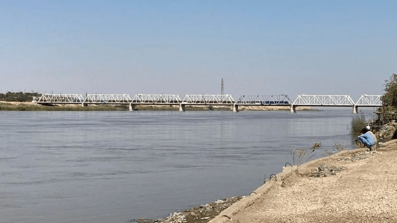
During the first week of June 2026, World Food Programme Afghanistan Country Director John Aylieff, Supply Chain Officer Shukhratmirzo Khodzhaev, and TCA’s Javier M Piedra visited the Termez–Hairatan border crossing and the Termez Free Economic Zone (TFEZ), a logistics hub between Uzbekistan and Afghanistan on the Amu Darya River. The trip was organized by the Institute for Strategic and Regional Studies (ISRS) in connection with Termez Dialogue 2026, a flagship Uzbekistan initiative designed to advance economic integration, trade, and cultural exchange across Central and South Asia. For 25 years, Uzbekistan has maintained the Termez crossing as a key humanitarian gateway, ensuring Afghanistan’s continued access to regional and global supply chains. [caption id="attachment_51321" align="aligncenter" width="850"] Geographical position of the Amu Darya; source: snipview.com/amudarya[/caption] A quarter-century on, the gateway that has saved millions of Afghans from famine remains open, but the funding that makes it so meaningful is on life support. While Central Asia has stepped up, its increased contributions only partially offset the huge shortfall left by wealthier countries. Termez, Uzbekistan Twenty-five years ago, with winter approaching, borders closed, logistics shattered, and five million Afghans in urgent need of food, WFP's Petar Bojilov and Tim Lavelle—on loan to USAID OFDA's DART from USUN Rome—took on an impossible mission: to open a lifeline and get emergency food aid across the Amu Darya River from Uzbekistan into Afghanistan. What began with one barge and a handful of hopelessly underequipped and understaffed personnel in 2001 has become one of the world's most consequential logistics hubs, through which WFP has delivered over 220,000 metric tons of food into Afghanistan in recent years. In 2026, the Bridge of Friendship Marks its 25th Anniversary Once a barely functional border crossing, Termez is now a Free Economic Zone (AIRITOM) with multimodal connectivity and extensive storage, providing WFP with what John Aylieff calls unmatched operational flexibility. “What makes the Termez hub today so strategically important is its reliability and versatility,” says Aylieff. “It offers dependable transshipment through multiple Afghan corridors—a vital lifeline where speed matters – as well as loading and storage. Given current geopolitical tensions, from the closure of the Pakistan–Afghanistan border to the spillover of the Middle East crisis, its role has become even more essential for humanitarian operations.” [caption id="attachment_51320" align="aligncenter" width="761"] John Aylieff and Javier Piedra, Termez (June 7th, 2026). Image: TCA[/caption] Since February 2026, violence along Afghanistan's 2,400-kilometre border with Pakistan has escalated sharply, triggering the displacement of approximately 20,000 families. With heightened instability along the Afghan-Pakistan border and in Iran, forced returns of Afghan refugees have increased sharply; the Termez transit corridor has become all the more critical as a channel for humanitarian food aid. Termez's value extends well beyond WFP's own operations. "The hub not only serves WFP in Afghanistan but also supports numerous humanitarian agencies in the country, including UNHCR, UNFPA, and UNICEF," says Aylieff. "It is the backbone of the northern corridor supply chain into Afghanistan, and more and more agencies are relying on WFP's logistics capabilities to bring their...

Tajikistan Warns of Mudslides as Central Asia Expands Flood Cooperation

Authorities in Tajikistan say heavy rain could trigger mudslides in parts of the country in the coming days and have warned people to be extremely careful when traveling on roads near mountains and riverbanks. The warning was issued on Wednesday, days after government officials, scientists, and other delegates from across Central Asia met in Bishkek to discuss ways to address cross-border mudflows and floods. The three-day meeting, which ended on Friday, was organized by Kyrgyzstan’s Ministry of Emergency Situations and the Regional Environmental Center for Central Asia, a group that gets support from the World Bank and other international partners. Mudslides and flooding often hit parts of Central Asia in the spring and early summer, when rainfall, rising temperatures, snow and glacier melt, and increasing water levels threaten communities that scientists say are more vulnerable because of climate change. In the spring of 2024, flooding in Kazakhstan displaced thousands of people and damaged many homes and other buildings in what the government called the worst natural disaster in the country in 80 years. Central Asian governments are increasing cooperation on mitigation measures, including early warning systems, data sharing, and other projects to better protect their populations. As temperatures rise faster in Central Asia than the global average, Tajikistan is especially vulnerable because it is a mountainous country where glacier melt is a growing concern. Heavy rains and mudslides are possible through Friday, July 3, in mountainous and hilly areas across the country, as well as in Sughd Region in northwest Tajikistan, which borders Uzbekistan, and in Khatlon Region in the southwest, which borders Uzbekistan and Afghanistan, Tajikistan’s Ministry of Transport said. Citing meteorological experts, the ministry also warned of dust storms in Khatlon and the capital, Dushanbe, because of strong winds blowing from the south. “As a result of rising temperatures, glacier melt, and increasing water levels in the Panj, Vakhsh, Varzob, and Zeravshan rivers, there is a risk of mudflows in these areas,” the ministry said. It added that it had “instructed all road maintenance departments and institutions to monitor the condition of highways around the clock.” The possibility of flooding from glacier melt and rising river levels is not only a problem in mountainous areas in upstream countries such as Tajikistan and Kyrgyzstan, but also in downstream countries, including Kazakhstan, Uzbekistan and Turkmenistan, that rely on cross-border water supplies but are also vulnerable to natural disasters. Turkmenportal, an online news site, said the recent meeting in Kyrgyzstan on water cooperation in Central Asia was important to Turkmenistan because it “is located in the lower reaches of Central Asia's largest rivers and is directly dependent on the quality of transboundary cooperation in water management and flood risk reduction.”

Pamir Glaciers Rapidly Melting Even Above 5,000 Meters, Tajik Scientists Warn

Tajik scientists have conducted the country’s first direct winter field measurements of snow dynamics on a Pamir glacier since independence, with findings showing a sharp decline in snow reserves and accelerated melting even in high-altitude zones previously considered relatively stable. The expedition took place from May 6-15 on Glacier No. 457, located in the upper basin of the Nukhchashma River, also known as Tokuzbulak, a tributary of the Gunt River. The research was carried out by specialists from the Mountain Societies Research Institute at the University of Central Asia (UCA), together with the Center for Research of Glaciers of Tajikistan’s National Academy of Sciences, as part of the United Nations initiative “Decade of Action for Cryospheric Sciences, 2025-2034.” The scientists’ primary objective was to study the glacier’s winter mass balance by analyzing snow accumulation, density, and distribution across the glacier surface. According to the organizers, these are the first direct winter field measurements of glacier winter snow dynamics conducted in Tajikistan since the country gained independence. The work comes as glacier preservation is receiving growing international attention. The United Nations says rapid glacier melt threatens billions of people, especially those who depend on glaciers for drinking water, agriculture, and energy. Tajikistan’s glaciers are particularly important for Central Asia because they feed rivers that support downstream communities, irrigation, and hydropower. Previous glacier monitoring efforts in Tajikistan were largely limited to summer expeditions and satellite observations. Denis Samyn, senior research fellow and professor of Earth and environmental sciences at UCA, said Central Asia’s glaciers had remained insufficiently studied for decades. “Now, with support from the state and international partners, the region is gradually developing its own school of cryospheric research and a new generation of specialists,” he said. Scientists expressed particular concern over the latest monitoring results. UCA researcher Hofiz Navruzshoev said Glacier No. 457 has been monitored annually since 2020, although previous studies primarily focused on summer melting. “The 2025 observations revealed a critical situation: the glacier’s thickness decreased by more than one meter, which is a very significant indicator,” he said. According to Navruzshoev, seasonal snow cover in the glacier’s accumulation zone at elevations above 5,100 meters has virtually disappeared over the past five years. This means the glacier is no longer replenishing lost ice even in its upper accumulation areas, which traditionally served as long-term snow storage zones. That trend is significant because the accumulation zone is the part of a glacier where winter snow normally survives long enough to compact into ice. If that zone stops gaining snow, the glacier can lose mass even before lower-elevation melting is taken into account. The expedition operated under difficult high-altitude conditions, with researchers working at elevations of around 5,000 meters amid rapidly changing weather, snowfall, strong winds, and near-zero visibility. During the mission, scientists dug five snow pits at elevations ranging from 4,790 to 5,012 meters, measured snow depth and density, and collected data on glacier snow reserves. The findings add to wider scientific concern about the Pamirs. The Times of...