• KGS/USD = 0.01143 0%
  • KZT/USD = 0.00207 0%
  • TJS/USD = 0.10465 0.1%
  • UZS/USD = 0.00008 0%
  • TMT/USD = 0.28571 0.28%
  • KGS/USD = 0.01143 0%
  • KZT/USD = 0.00207 0%
  • TJS/USD = 0.10465 0.1%
  • UZS/USD = 0.00008 0%
  • TMT/USD = 0.28571 0.28%
  • KGS/USD = 0.01143 0%
  • KZT/USD = 0.00207 0%
  • TJS/USD = 0.10465 0.1%
  • UZS/USD = 0.00008 0%
  • TMT/USD = 0.28571 0.28%
  • KGS/USD = 0.01143 0%
  • KZT/USD = 0.00207 0%
  • TJS/USD = 0.10465 0.1%
  • UZS/USD = 0.00008 0%
  • TMT/USD = 0.28571 0.28%
  • KGS/USD = 0.01143 0%
  • KZT/USD = 0.00207 0%
  • TJS/USD = 0.10465 0.1%
  • UZS/USD = 0.00008 0%
  • TMT/USD = 0.28571 0.28%
  • KGS/USD = 0.01143 0%
  • KZT/USD = 0.00207 0%
  • TJS/USD = 0.10465 0.1%
  • UZS/USD = 0.00008 0%
  • TMT/USD = 0.28571 0.28%
  • KGS/USD = 0.01143 0%
  • KZT/USD = 0.00207 0%
  • TJS/USD = 0.10465 0.1%
  • UZS/USD = 0.00008 0%
  • TMT/USD = 0.28571 0.28%
  • KGS/USD = 0.01143 0%
  • KZT/USD = 0.00207 0%
  • TJS/USD = 0.10465 0.1%
  • UZS/USD = 0.00008 0%
  • TMT/USD = 0.28571 0.28%

Viewing results 1 - 6 of 12

Seismic Cities: Is Central Asia Prepared for a Major Earthquake?

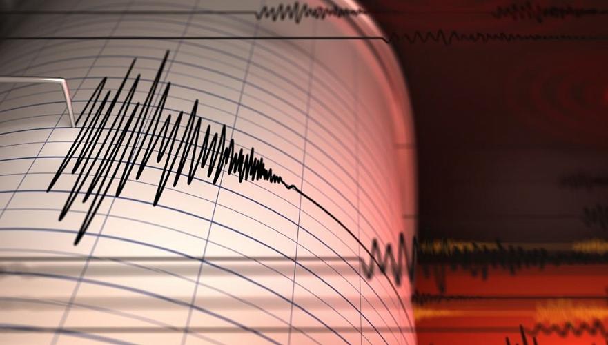
The recent 7.7-magnitude earthquake in Myanmar, which claimed over 3,500 lives and caused structural failures more than 1,000 kilometers away in Bangkok, has once again highlighted the precariousness of life in seismically active regions. “Earthquakes happen on geological faults, which are often sited at the edges of mountain ranges.” Richard Walker, Professor of Tectonics at the University of Oxford told The Times of Central Asia. “Sadly, the edges of mountain ranges are often the best places to live, due to the presence of water and of land for farming.” All Central Asian capitals, except for Kazakhstan’s relocated capital Astana, are located on such terrain. This has historically made them vulnerable. The 1948 earthquake in Ashgabat destroyed almost the entire city; Tashkent suffered a similarly destructive event in 1966, and Almaty was wracked by twin blows in 1887 and 1911. Although no such catastrophic event has occurred in the last half century, the earth beneath the region continues to rumble restlessly. Two quakes in early 2024 left the residents of Almaty unnerved. Last week, on April 14, a 5.9 magnitude earthquake in Tajikistan caused the death of a young boy and damage to around thirty homes near the Chinese border. Though moderate, these tremors serve to remind residents of the active tectonics of the region and raise questions about the structural readiness of buildings and infrastructure should a stronger event occur. Botched Building After the 2023 earthquake on the Turkey-Syria border, which killed over 53,000 people in Turkey alone, authorities launched investigations into over a hundred individuals linked to the construction of buildings that did not withstand the tremors. Such stories were familiar to people who grew up in the Soviet Union. In the 1988 Spitak earthquake in Armenia, tens of thousands died in Leninakan (now Gyumri). Many of the casualties were put down to the collapse of identikit 9-storey tower blocks built in the Brezhnev era. These were designed to withstand a magnitude 7 earthquake; in the event, the 6.8 magnitude quake that struck Leninakan caused 72 out of 78 of these buildings to collapse. In a bitter irony, many older, pre-Soviet structures remained intact. One team of international inspectors blamed “very low construction standards and suspect joint details” in Leninakan for the scale of the disaster. Similar precast tower blocks to those that collapsed in Armenia can be seen across the former USSR. According to the Uzbek media, the Cabinet of Ministers estimated in 2023 that approximately 70% of private housing in the country failed to meet current earthquake resistance standards. “The 2023 earthquake in Turkey was a tragic reminder of the importance of strict compliance with building codes and continuous quality control of construction in seismic regions,” Daulet Sarsenbayev, director of the Kazakhstan’s National Scientific Center for Seismological Observations and Research, told TCA. “Such events provide valuable lessons for all countries, including Kazakhstan, in terms of the need to strengthen the regulatory framework, increase transparency in the construction industry, and invest in resilient infrastructure.” In response to the...

Two Earthquakes Strike Kazakhstan and Kyrgyzstan, Causing Damage in Talas Region

Two earthquakes struck Central Asia early on March 28, affecting parts of Kazakhstan and Kyrgyzstan. The first tremor, with a magnitude of 5.5, occurred in southern Kazakhstan, approximately 133 kilometers from Bishkek. The Kyrgyz capital felt the tremors at 4:42 a.m., according to the Institute of Seismology at the National Academy of Sciences of Kyrgyzstan. The quake registered a strength of four points in Bishkek and reached up to five points in parts of Kyrgyzstan’s Talas Region, which borders Kazakhstan. A second, less powerful earthquake was recorded at 7:00 a.m. on the Chatkal Ridge in southwestern Kyrgyzstan. It registered a magnitude of 3.5. According to the Kyrgyz Ministry of Emergency Situations, five residential buildings and one educational institution sustained damage in the Talas Region following the first quake. An operational team has been dispatched to assess the extent of the damage. “A state of emergency has been declared in connection with the earthquake recorded in Kazakhstan on March 28. An emergency meeting was held at 5 a.m. at the central office of the Ministry of Emergency Situations and the Crisis Management Center of Kyrgyzstan. First Deputy Minister of Internal Affairs Azamat Mambetov instructed officials to maintain a high alert regime,” the ministry's press service reported. No casualties have been reported. Authorities have stated that the situation remains under control. Kyrgyzstan’s Crisis Management Center is in direct communication with its counterpart in Kazakhstan, with both agencies exchanging real-time updates. Two major earthquakes were also recorded on March 28 in Southeast Asia. Seismologists from China and the United States reported tremors affecting Myanmar and Thailand. In Myanmar, the first quake registered a magnitude of 7.9 (with other sources citing 7.7), followed by a second at 6.4. The tremors were also felt in Bangladesh, India, Thailand, Laos, and China.

Anniversary of the Ashgabat Earthquake Tragedy

In every city's history, there are events that forever change its image and the fate of its inhabitants. The night of October 5-6, 1948, marked a turning point for Ashgabat, with a tragic event which still resonates in the hearts of those who lived through it. On that warm October evening, no one in Ashgabat could ever have predicted that the next few hours would forever change the fates of tens of thousands of people. Life in the city continued as usual, music played in the parks, lovers strolled along the streets, and students prepared for classes. The starry sky promised a peaceful night... Founded in 1881, when seismology was still young, Ashgabat grew and developed, oblivious to any impending danger. Traditional adobe construction —a mixture of clay and straw—seemed ideal for the dry climate. Year on year, residents renewed their clay roofs, adding new layers without considering that the increasing weight could be a death trap. “Only the stone building of the Central Committee of the Communist Party of Turkmenistan and a few other important buildings were made of quality bricks,” recalled one eyewitness. “It was these buildings, though damaged, that survived, while virtually the rest of the city was reduced to rubble.” [caption id="attachment_24231" align="aligncenter" width="300"] @mchs.gov.ru[/caption] “In the middle of the night - we heard- a menacing rumble, then rumbling and cracking as the ground shook and shimmered...” said one of the survivors, recalling the beginning of the tragedy. At 1.14 am on October 6, 1948, something happened that many Ashgabat residents believed was the start of a new war. Within but a few seconds, the city was a ruin. Academician Dmitry Nalivkin, who was at the epicenter of events, describes the harrowing event: “There was something incredible, impossible outside the window. Instead of a dark transparent starry night, there was an impenetrable milky-white wall in front of me, and behind it - horrible moans, screams, cries for help.” [caption id="attachment_24232" align="aligncenter" width="300"] @mchs.gov.ru[/caption] According to Nalivakin, the city was completely paralyzed. Telephone communications were interrupted, the train station turned into a pile of rubble, and the airfield was destroyed. Overnight, the capital of the republic was cut off from the outside world. In a matter of seconds, 98% of the city was rubble. Lieutenant Colonel of Medical Service Tikhon Boldyrev describes the first minutes after the catastrophe: “A deafening noise like a deep sigh swept through the city, and immediately there was dead silence. The air was filled with thick, suffocating dust. There was no sound, no cries for help, no animal sounds; it was as if every living thing had perished beneath the ruins.” In the darkness, in a dense veil of dust, survivors raked through the rubble with their bare hands, trying to save their loved ones. Alevtina Dubrovskaya, a resident of Ashgabat, recalls, “I found myself covered from head to toe with a mat hanging over my bed, but there was some space with air under it, which saved me from suffocation...” [caption...

Seismologists From Japan to Study Earthquakes in Almaty

Japanese experts in the field of seismology will come to Almaty, Kazakhstan's largest city, to study the nature of recent earthquakes there. According to the foreign ministry, a seminar on seismic safety will be organized by the Kazakh Agency for International Development (KazAID). "The co-organizers of the event are the Japanese International Development Agency (JICA), the Kazakh Research and Design and Experimental Institute of Earthquake Engineering (KazNIISA) and the Center for Emergency Situations and Disaster Risk Reduction," a statement said. Japanese seismologists will share their experience with Central Asian counterparts. They will present advanced technologies and standards of seismic isolation, as well as discuss possible cooperation in seismic construction practices. Japanese seismologists will also study the recent earthquakes in Almaty, to allow Kazakh specialists to develop strategies to prevent risks in the future. As previously reported, on January 23 and March 4 in Almaty, sensors recorded tremors with magnitudes of more than five points on the Richter scale. Experts say that the fluctuations of the Earth's crust had an unusual structure for the region.

Scientists in Kyrgyzstan Predicting More Earthquakes

Speaking to members of Parliament, the head of the Cabinet of Ministers of Kyrgyzstan, Akylbek Japarov, said that 13,000 seismic shocks have been recorded in Kyrgyzstan just this year. According to Japarov, specialists are currently studying dangerous zones. "Only on April 2, 828 earthquakes were registered worldwide within 24 hours, and 6,892 in seven days... Over the past 150 years, more than a dozen earthquakes with a magnitude above seven have occurred on the territory of the republic," Japarov said. The prime minister noted that scientists from the Kyrgyz National Academy of Sciences are now studying dangerous zones where destruction can be expected. In addition, he instructed members of parliament to strengthen regulatory control over the seismic resistance of buildings, as well as the quality of facilities under construction. Following a strong earthquake on the border of Kyrgyzstan and China in late February this year (seven points in its epicenter), the authorities of Kyrgyzstan created an interdepartmental commission to check buildings that are at risk of being destroyed, but that commission didn't record serious damage at that time. Additionally, special services raided construction sites. Despite corruption scandals in the industry - several directors of large construction companies are under investigation - the special services did not identify any major violations. Meanwhile, according to the National Academy of Sciences of Kyrgyzstan, in 2024 the republic is indeed among the top five countries in terms of earthquakes registered. In 2023, the Institute of Seismology of Kyrgyzstan recorded twice as many tremors as a year earlier. At the same time, most of these tremors were not felt by people, they were recorded only by special devices. However, the public shouldn't worry too much about it, Kanatbek Abdrakhmatov, the country's chief seismologist said, adding that any seismic activity has its own periodicity. "We are now living in the fourth period of seismic activity, which began in 2008 and will end according to our forecasts in 2026... The strength of earthquakes in this active period was not supposed to exceed 5-6 points. Until today, these predictions have been realized. The only event that exceeded our expectations was the Chinese earthquake on February 23, 2024. Well, it happens! Don't be afraid, people!" Abdrakhmatov, head of the laboratory at the Institute of Seismology of Kyrgyzstan, wrote on his Facebook page. As a mountainous country, Kyrgyzstan is in an earthquake-prone zone, and in recent months the country's residents have felt more tremors than usual. The Institute of Seismology believes there is nothing to fear, because the tremors are not strong, but the panic that these tremors can provoke is much more dangerous. That's why, almost every time there is another tremor in Kyrgyzstan, the head of the Institute of Seismology writes a note on his social media, attempting to reassure the population. "Probably many people felt the small earthquake that occurred a few minutes ago. The epicenter was in the mountains, under the Kyrgyz ridge, about 25-30 kilometers south of Bishkek. In Bishkek it was 2-3 points. Nothing...

Earthquakes Rekindle Fears Over Lake Sarez

On the evening of January 30th, an earthquake struck in the Gorno-Badakhshan Autonomous Province on the border between Tajikistan and Xinjiang. Though this instance only had a magnitude of 4.4, it comes in the wake of the magnitude 7 quake which pounded the China-Kyrgyzstan border on January 23rd, shaking buildings in Almaty. As recently as February 2023, a series of earthquakes, the largest measuring 6.8, hit forty miles west of Murgab on the border between Tajikistan and China’s Xinjiang province. This was the eighteenth such instance measuring 6.5 or more over the course of the last century, and serves to focus attention on extremely remote Lake Sarez in Tajikistan. [/vc_column_text][vc_single_image image="14212" img_size="full" el_class="scond-image" parallax_scroll="no" woodmart_inline="no"][vc_column_text woodmart_inline="no" text_larger="no"]Plan of Lake Sarez and the Usoi Dam, 1913 At five-hundred-meters deep and 47 miles long, mountainous Lake Sarez contains more than 3.85 cubic miles of water. It was formed in 1911, when a 2.2 billion cubic meter landslide caused by an earthquake with an estimated magnitude of 6.5-7.0 blocked the Bartang River’s path. The sound of the quake was recorded over 2,350 miles away at the Pulkovo seismic station near St. Petersburg. Thus, the tallest natural dam in the world, the three-mile long, 567-meter high Usoi Dam was formed, whilst the villages of Usoi and Sarez were buried beneath the landslide and the lake, respectively, killing 302 people. According to the two survivors, the dust clouds cleared only after some days to reveal a mountain where the village of Usoi used to stand. The lake has been a potential disaster waiting to happen ever since. In 1968, a landslide caused two-meter-tall waves to rock the lake, and with glacial melting causing water levels to rise by eight inches a year, pressure on the natural dam is building. As early as the 1970s, plans were hatched to harness the lake as a hydroelectric power station, but technical issues and its far-flung location saw the scheme come to nothing. In 2018, a deal was signed with Hong Kong-based Heaven Springs Harvest Group to sell the lake’s “blue gold” as drinking water, but inaccessibility again largely scuppered the project.[/vc_column_text][vc_single_image image="13414" img_size="full" el_class="scond-image" parallax_scroll="no" woodmart_inline="no"][vc_column_text woodmart_inline="no" text_larger="no"]Murgab Bazaar, Gorno-Badakhshan - Photo: Times of Central Asia Back in 1997, a gathering of experts in Dushanbe concluded that the Usoi Dam was unstable. Their findings suggested that a powerful earthquake could precipitate a collapse of the dam. However, a study conducted by the World Bank in 2004 contradicted these conclusions, arguing that the dam was, in fact, stable. Nevertheless, the main threat identified was not the dam's general stability but a specific geological feature - a partially detached mass of rock, approximately 0.72 cubic miles in size. There are concerns that this precarious massive rock formation could detach and plunge into the lake. This event could trigger a catastrophic flood, and, as such, while the dam itself may be stable, the potential for disaster still looms large. In this earthquake-prone environment, were the dam to be breached a tidal...