• KZT/USD = 0.00213
  • TJS/USD = 0.10800
  • UZS/USD = 0.00008
  • TMT/USD = 0.29850
  • KZT/USD = 0.00213
  • TJS/USD = 0.10800
  • UZS/USD = 0.00008
  • TMT/USD = 0.29850
  • KZT/USD = 0.00213
  • TJS/USD = 0.10800
  • UZS/USD = 0.00008
  • TMT/USD = 0.29850
  • KZT/USD = 0.00213
  • TJS/USD = 0.10800
  • UZS/USD = 0.00008
  • TMT/USD = 0.29850
  • KZT/USD = 0.00213
  • TJS/USD = 0.10800
  • UZS/USD = 0.00008
  • TMT/USD = 0.29850
  • KZT/USD = 0.00213
  • TJS/USD = 0.10800
  • UZS/USD = 0.00008
  • TMT/USD = 0.29850
  • KZT/USD = 0.00213
  • TJS/USD = 0.10800
  • UZS/USD = 0.00008
  • TMT/USD = 0.29850
  • KZT/USD = 0.00213
  • TJS/USD = 0.10800
  • UZS/USD = 0.00008
  • TMT/USD = 0.29850

Viewing results 1 - 6 of 74

Uzbekistan Installs 37 Air Monitoring Stations in Aral Region as Environmental Cooperation Expands

Authorities in the region of Karakalpakstan have installed 37 automated air quality monitoring stations to track pollution levels in the Aral Sea region, according to Uzbekistan’s National Committee on Ecology and Climate Change. The project was implemented in cooperation with the United Nations Development Programme (UNDP). The system measures fine particulate matter, including PM2.5 and PM10, as well as gases such as carbon monoxide, nitrogen dioxide, ozone, and hydrogen sulfide. It also records key meteorological indicators, including temperature, humidity, air pressure, and wind speed. Data is transmitted in real time through the Aurisgreentech system, which officials say reduces human error and improves accuracy. During a recent visit to the region, UNDP's representative in Uzbekistan Akiko Fujii reviewed the work of the regional ecology committee's Situation Center, where monitoring results are processed. According to official reports, she also inspected a laboratory equipped to analyze air, water, and soil samples in line with international standards. “The United Nations will continue to support projects aimed at improving the environmental situation in Karakalpakstan,” Fujii said, noting the importance of reliable data in assessing pollution and forecasting ecological risks. The initiative comes as regional cooperation on environmental challenges gains momentum. From April 22 to 24, Astana will host a regional ecological summit bringing together UN agencies, international organizations, and government representatives from Central Asia and the Caspian region. The summit will include a ministerial session led by the World Health Organization focusing on the health impacts of environmental degradation in the Aral Sea area. Discussions are expected to address the links between pollution, public health, and the need for coordinated responses across borders.
1853 Map of the Aral Sea Published in the Journal of the Royal Geographical Society

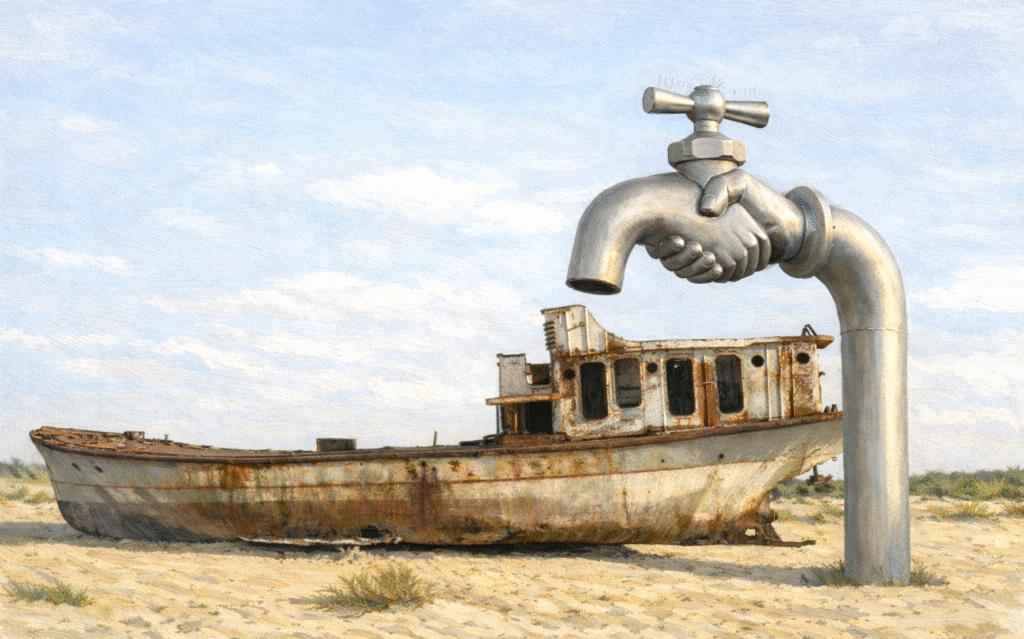
An 1853 map of the Aral Sea, published in the Journal of the Royal Geographical Society, depicts the vast inland water body at a time when it was near its historical peak. The engraving, created by German cartographer August Petermann, was based on findings from a scientific expedition conducted in 1848-1849, according to historical materials referenced in the project. The expedition, led by Russian naval officer Alexey Butakov, produced one of the first detailed studies of the Aral Sea. Researchers measured its depth, mapped its coastline, and documented its islands, providing a comprehensive picture of a body of water that would later become a symbol of environmental degradation. Although widely referred to as a sea, the Aral is in fact a lake. In the 20th century, it ranked as the world’s fourth-largest lake. Scientific evidence suggests it formed around 17,600 years ago as a result of glacial melt. Initially freshwater, it became increasingly saline over time, while its water levels fluctuated over centuries. From the 1960s, however, the lake began to shrink rapidly. Large-scale irrigation projects diverted water from the Amu Darya and Syr Darya rivers, primarily for cotton cultivation. Over the following decades, the Aral Sea lost more than 90% of its volume, transforming much of the region into desert and salt plains, and severely disrupting ecosystems and local livelihoods. In 1989, the lake split into two separate bodies. The southern part, largely located in Uzbekistan, has almost completely dried up, forming the Aralkum Desert. The northern section has shown some stabilisation, supported in part by infrastructure such as the Kokaral Dam. This transformation, and its historical context, will be explored in Uzbekistan’s cultural exhibition When Apricots Blossom, which draws on archival materials and contemporary interpretation. The exhibition takes its name from a poem by Hamid Olimjon, written in the 1930s, symbolising hope and renewal. According to organisers, the project will combine history, art, and environmental reflection to present the story of the Aral Sea to an international audience. The exhibition will run from April 20 to 26, at Palazzo Citterio in Milan’s Brera district as part of Milan Design Week.

From a Vanishing Sea to Milan’s Spotlight: When Apricots Blossom, a Lost Sea Speaks

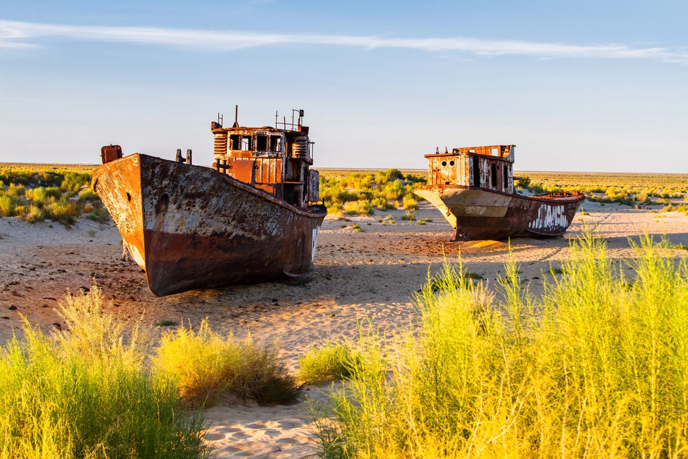
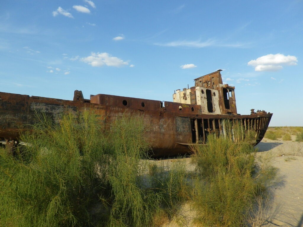
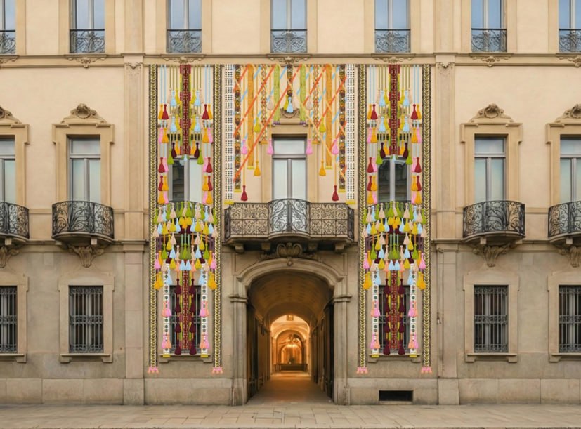
From April 20 to 26, 2026, Uzbekistan will present one of its most ambitious cultural projects to date at the Milan Design Week. Titled When Apricots Blossom, the exhibition will take place at Palazzo Citterio in Milan’s Brera district, transforming the historic space into a multi-layered exploration of craft, memory, and environmental change. Organized by the Uzbekistan Art and Culture Development Foundation, the exhibition is commissioned by its chairperson, Gayane Umerova, and curated by architect Kulapat Yantrasast, founder of WHY Architecture. Bringing together twelve international designers and Uzbek artisans, the project explores how traditional knowledge can help societies respond to environmental crises. At its core lies Karakalpakstan, an autonomous region in northwestern Uzbekistan that has experienced one of the world’s most severe ecological disasters. A Story Rooted in Loss and Resilience The exhibition takes its name from a poem by Hamid Olimjon, written in the 1930s as a reflection on hope and renewal. Today, that symbolism carries renewed relevance. For decades, the Aral Sea has been shrinking. Once one of the largest inland bodies of water in the world, it has lost more than 90% of its volume since the 1960s, largely due to irrigation policies that diverted its feeder rivers. The result is a transformed landscape of desert, salt plains, and fragmented ecosystems, with communities forced to adapt to rapid environmental change. [caption id="attachment_30520" align="aligncenter" width="2560"] Moynaq. Aral Culture Summit 2025; image courtesy of Iwan Baan and ACDF[/caption] Rather than focusing solely on loss, When Apricots Blossom highlights how communities continue to live, create, and adapt. Visitors enter through a façade transformed by a large textile installation by British designer Bethan Laura Wood, created in collaboration with Uzbek artisans. Drawing on decorative elements used in nomadic yurts, tassels, ribbons, and woven patterns, the work creates a vivid and tactile threshold. Inside the courtyard, an installation of apricot trees by Uzbek floral artist Ruben Saakyan sets the tone. The apricot, both a symbol of hospitality and a key Uzbek export, also reflects resilience, continuing to grow even in the harsh conditions of the Aral Sea region. Further inside, a “deconstructed yurt” designed by WHY Architecture serves as a central gathering space, reflecting the adaptability of nomadic shelter traditions. Craft as Knowledge, Not Decoration For Umerova, this distinction is central. “Craft in Karakalpakstan is more than tradition, it is a system of knowledge,” she told The Times of Central Asia. “It has evolved over centuries in close relationship with the land.” [caption id="attachment_46319" align="aligncenter" width="1440"] Handwoven textiles on a traditional loom at “When Apricots Blossom”; image: ACDF[/caption]   Umerova notes that materials such as wood, silk, felt, ceramic, and reed reflect a deep understanding of local ecosystems. These practices are passed down through generations, carrying both technical skills and cultural knowledge. In the context of the Aral Sea crisis, this knowledge takes on renewed importance. “The communities there have long developed ways of adapting to changing environments,” she told TCA. “Their craft traditions embody this resilience.” For Umerova, sustainability is as...

Central Asia and the Global Water Crisis: A Test of Governance and Cooperation

Water scarcity is rapidly transforming from a regional environmental concern into one of the defining global security challenges of the 21st century. UN-linked assessments estimate that around four billion people experience severe water scarcity for at least one month each year, and nearly three-quarters of the global population lives in countries facing water insecurity. Against this backdrop, Central Asia is not an exception but rather a concentrated example of global dynamics: climate pressure, population growth, and inefficient resource management. Regional initiatives, including proposals put forward by Kazakhstan, therefore have the potential to contribute not only to stability in Central Asia but to the development of a more coherent global water governance architecture. The Water Crisis as a Global Reality Water is increasingly regarded as a strategic resource on par with energy and food. Climate change is intensifying droughts, floods, and the degradation of aquatic ecosystems across all regions, from Africa and the Middle East to South Asia, Europe, and North America. Recent mapping and analysis by investigative groups and international media indicate that half of the world’s 100 largest cities experience high levels of water stress, with dozens classified as facing extremely high levels. Major urban centers, including Beijing, New York, Los Angeles, Rio de Janeiro, and Delhi, are among those under acute pressure, while cities such as London, Bangkok, and Jakarta are also categorized as highly stressed. In this context, Central Asia is not an outlier. It is confronting today what may soon become the global norm. Central Asia: Where Global Trends Converge A defining feature of the current environmental situation is that factors beyond natural ones drive the water crisis. Experts increasingly stress that shortages are often less about absolute physical scarcity and more about outdated management systems, infrastructure losses, and inefficient consumption patterns. In this respect, Central Asia can be seen as a testing ground for global water challenges, where multiple stress factors converge. The region, with mountain peaks exceeding 7,000 meters, contains some of the largest ice reserves outside the polar regions. The Pamir and Hindu Kush ranges, together with the Tibetan Plateau, the Himalayas, and the Tien Shan, form part of what is sometimes referred to as the “Third Pole,” the largest concentration of ice after the Arctic and Antarctic. [caption id="attachment_13410" align="aligncenter" width="2560"] The White Horse Pass, Tajikistan; image: TCA, Stephen M. Bland[/caption] However, the pace of change is alarming. By 2030-2040, water scarcity in Central Asia risks becoming chronic. Glaciers in the Western Tien Shan, for example, have reportedly shrunk by roughly 27% over the past two decades and continue to retreat, posing a direct threat to the flow of the Amu Darya and Syr Darya rivers. These rivers increasingly fail to reach the Aral Sea in sufficient volume, while the exposed seabed has become a major source of salt and dust storms. [caption id="attachment_21928" align="aligncenter" width="2560"] Moynaq, Karakalpakstan; image: TCA, Stephen M. Bland[/caption] Infrastructure inefficiencies compound the problem. Estimates suggest that in some systems, 40-50% of water can be lost in deteriorating...

Astana Accelerates Northern Aral Sea Recovery Plan

The Kazakh government plans to accelerate the second phase of the project to restore the Northern Aral Sea. Prime Minister Olzhas Bektenov has instructed the Ministry of Water Resources and Irrigation to secure financing for the second phase of the project by the end of 2026. The goal is to increase the volume of water in the Northern Aral Sea by around 10–11 billion cubic meters over the next four to five years. History of Degradation and Early Restoration Results The Aral Sea, which straddles the border between Kazakhstan and Uzbekistan, began to shrink rapidly in the 1960s due to large-scale irrigation projects that diverted water from the Amu Darya and Syr Darya rivers for cotton cultivation and other agricultural needs. As a result of the sea’s degradation, the Northern Aral Sea separated in 1987 and has since been sustained largely through the construction of the Kokaral Dam. In 2012, the sea and the Syr Darya delta were added to the Ramsar List of Wetlands of International Importance. Since then, Kazakhstan has undertaken systematic efforts to restore the northern part of the former Aral Sea. Unlike earlier efforts to save the Aral Sea as a whole, Kazakhstan’s approach since the mid-2000s has been shaped by a narrower and more pragmatic premise: that partial restoration is environmentally and politically achievable, while attempts to revive the entire basin are not. The construction of the Kokaral Dam marked a turning point, demonstrating that targeted hydraulic interventions could stabilise water levels, reduce salinity, and revive fisheries in the northern basin, provided expectations were kept within achievable limits. The recovery has already enabled the return of small-scale fishing, improved local livelihoods, and reduced dust storms from the exposed seabed around Aralsk. This strategy reflected a deliberate acceptance that restoring the Northern Aral would come at the expense of the southern basin, prioritising long-term ecological viability over symbolic ambitions. Over the past several years, roughly 5 billion cubic meters of water have been redirected into the Northern Aral Sea basin, increasing its total volume to more than 23 billion cubic meters. This exceeds the targets set out in Kazakhstan's Water Resources Management Concept, which had forecast reaching 20.6 billion cubic meters by 2025, with that volume previously expected only by 2029. [caption id="attachment_24691" align="aligncenter" width="2560"] Tastubek Bay, Northern Aral Sea; image: TCA, Stephen M. Bland[/caption] Infrastructure Plans and International Support With the support of the World Bank, Kazakhstan is considering raising the height of the Kokaral Dam by up to two meters and constructing a new hydraulic facility. These upgrades aim to increase both the volume and quality of water in the Northern Aral Sea, rehabilitate the Syr Darya delta, and reduce salt dispersion from the exposed seabed. The second phase of the initiative targets increasing the sea’s volume to 34 billion cubic meters. Bektenov has directed the Ministry of Water Resources and Irrigation to finalize technical preparations by mid-2026 and secure financing by the end of the year, including through international partnerships. The second phase...

Planting Trees to Heal Old Wounds: Can a Desert Forest Save the Aral’s Last Residents?

In the Aralkum Desert, afforestation campaigns have multiplied since the early 2000s. They are meant to slow the sandstorms, temper a rapidly warming climate, and protect the health of those still living in the shadow of the Aral Sea. But the promised results have not appeared yet. The road from Aralsk to Aiteke Bi cuts through a palette of ochre and dust. Trucks drift forward in pale clouds, dragging the desert behind them like a long train. In these villages scattered along the former shoreline of the Aral Sea, the wind never leaves. It is abrasive, restless, and a witness to a vanished water body that once cooled the hottest corner of Kazakhstan. Respiratory diseases now run through family histories, and doctors say they can recognize lungs shaped by ecological collapse. At the polyclinic in Aiteke Bi, patients describe the same symptoms with weary precision: breath shortening too quickly, coughs that never fully recede, a fatigue that never seems to lift. Nuralay, 52, says the storms “get into the house, into the throat, into everything.” She admits she cannot remember a season without irritation in her chest. For Dr. Kuanyshqar Assilov, who has watched the pattern deepen for years, the cause is unmistakable: decades of airborne salts, pesticide residues, and industrial chemicals lifted from the dried seabed of the Aral Sea. [caption id="attachment_39897" align="aligncenter" width="1378"] In Aralsk, sand covers everything[/caption] Marat Narbaev, executive director of the International Fund to Save the Aral Sea (IFAS), recounts the disaster’s origins with a mixture of resignation and habit. He traces it back to the 1960s, when Soviet planners diverted the Amu Darya and Syr Darya to feed cotton monocultures. “The cotton was used to make clothing for soldiers and ammunition,” he says. Today, he argues, the basin faces two pressures: “climate change and demographic growth. Fifty million inhabitants… soon seventy.” In this landscape, the promise of restoring the region through afforestation has acquired symbolic weight. Saxaul trees - hardy, grey-green, capable of surviving in brackish soils - are planted by the millions on the exposed seabed. Officially, they are meant to stabilize sand, calm storms, and cool the surface. Unofficially, they carry the hope that life here might once be breathable again. Survivalist tree? On paper, the saxaul is a biological survivalist: roots plunging more than 30 feet deep, the ability to stabilize dunes, lower surface salinity, and grow dense enough within a few years to slow the wind. In Aralkum, a village east of Aralsk, residents praise the planting that lines a dozen houses. “It really worked, the storms became more bearable,” a man says. Then he shrugs: more trees should have been planted. “We asked for the other side of the village, but there’s no funding left.” Nowadays, half of the trees have died, and the rest lie buried beneath the dunes. [caption id="attachment_39896" align="aligncenter" width="1378"] In Aralkum village, half of the surviving trees barely emerge from the sand[/caption] Sometimes, past plantations have almost zero trees left. According to a 2021...