• KZT/USD = 0.00209
  • TJS/USD = 0.10820
  • UZS/USD = 0.00008
  • TMT/USD = 0.29850
  • KZT/USD = 0.00209
  • TJS/USD = 0.10820
  • UZS/USD = 0.00008
  • TMT/USD = 0.29850
  • KZT/USD = 0.00209
  • TJS/USD = 0.10820
  • UZS/USD = 0.00008
  • TMT/USD = 0.29850
  • KZT/USD = 0.00209
  • TJS/USD = 0.10820
  • UZS/USD = 0.00008
  • TMT/USD = 0.29850
  • KZT/USD = 0.00209
  • TJS/USD = 0.10820
  • UZS/USD = 0.00008
  • TMT/USD = 0.29850
  • KZT/USD = 0.00209
  • TJS/USD = 0.10820
  • UZS/USD = 0.00008
  • TMT/USD = 0.29850
  • KZT/USD = 0.00209
  • TJS/USD = 0.10820
  • UZS/USD = 0.00008
  • TMT/USD = 0.29850
  • KZT/USD = 0.00209
  • TJS/USD = 0.10820
  • UZS/USD = 0.00008
  • TMT/USD = 0.29850

Viewing results 1 - 6 of 65

Karakabak Silk Road Finds Reveal Ancient Trade Links

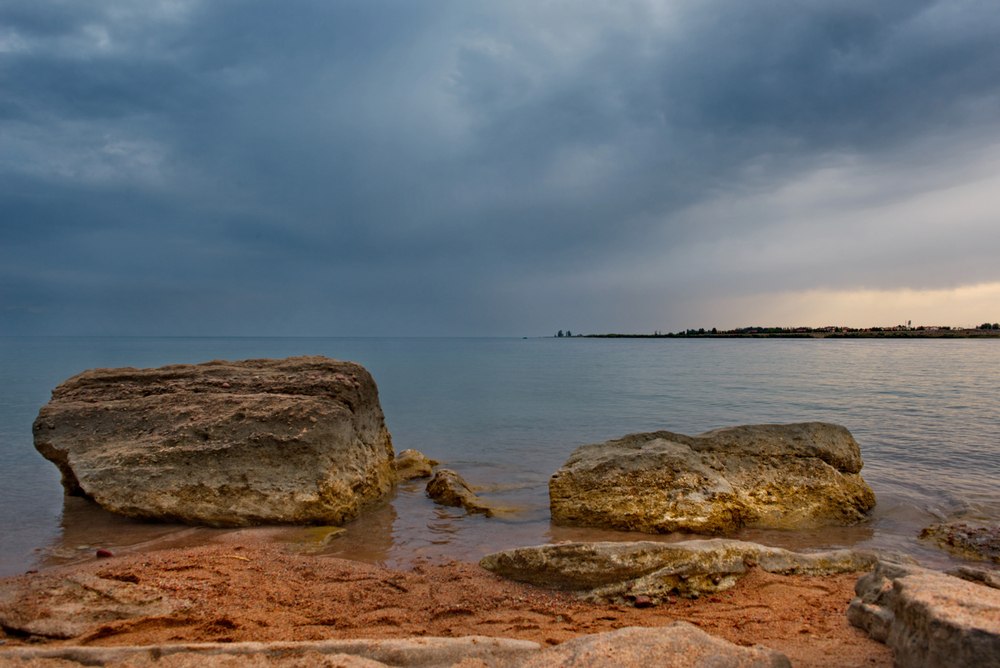
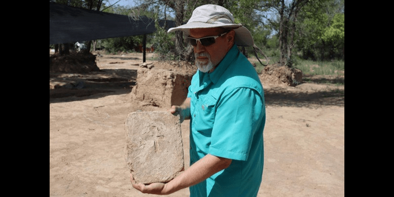
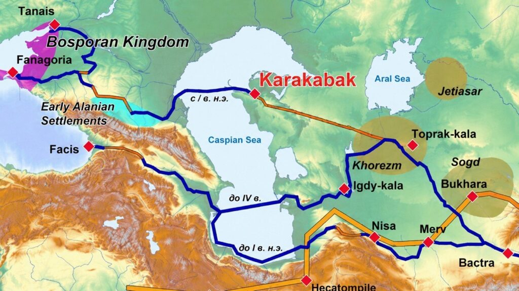
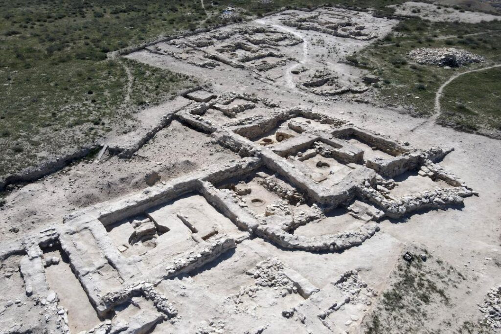
In 568, the Sogdian diplomat Maniakh led an embassy from the Turkic Khagan Istemi to the court of Byzantine Emperor Justin II. The mission sought to negotiate direct silk trade with the Byzantines and an alliance against Sasanian Iran, which controlled the principal overland routes between Central Asia and Byzantium. Historians have traditionally associated this diplomatic mission with the development of direct commercial and diplomatic links along the northern routes of the Silk Road. However, archaeological research conducted over the past decade in Mangystau, western Kazakhstan, has opened new perspectives on the study of ancient trade networks and offers a fresh interpretation of this long-held assumption. One of the most significant recent discoveries is the ancient settlement of Karakabak, located on the shore of Kochak Bay along the northeastern coast of the Caspian Sea. Preliminary evidence suggests that the settlement existed from the first century CE until the middle of the sixth century. The settlement likely emerged alongside the development of local mineral resources, including the extraction and processing of copper, iron, lead, and bitumen. Craftsmen at Karakabak produced jewelry, ceremonial and everyday belt fittings, clothing, weapons, horse harnesses, and saddles. Silver, gold, garnets, amber, lapis lazuli, carnelian, red coral, and pearls were imported for jewelry making and processed at the site. [caption id="attachment_51864" align="aligncenter" width="602"] Image: Andrey Astafyev[/caption] The settlement also produced a wide range of ceramic vessels, some of which were distributed well beyond the region. Glass beads and cullet were imported from across the Caspian Sea to support local glassworking. This provides compelling evidence that Karakabak was integrated into international economic networks during antiquity. Glass found at the site included material originating in both the Roman Empire and Iran. Taken together, the archaeological evidence allows Karakabak to be interpreted as a major manufacturing and processing center that participated in extensive interregional exchange networks serving the nomadic world. Archaeologists have recovered a substantial collection of more than 150 coins dating from the first century through the first half of the sixth century CE. The collection includes coins from Parthia, Ancient Khorezm, Bukhara Sogdiana, Sasanian Iran, the Kushano-Sasanian Kingdom, the Byzantine Empire, and China. [caption id="attachment_51866" align="aligncenter" width="1379"] Image: Andrey Astafyev[/caption] Research has established that Karakabak maintained commercial ties with the Zhetyasar culture in the lower Syr Darya region of present-day Kyzylorda Region, the Kerder culture in the Amu Darya delta, Sasanian Iran, Caucasian Albania, the North Caucasus, the Azov region, the Lower and Middle Volga, and the Southern Urals. This demonstrates the settlement’s high commercial and economic status. In terms of its role within international trade networks, Karakabak may be compared to the modern Port of Aktau on the Caspian Sea. The discovery of an entire enclave-type archaeological complex centered on Karakabak represents a unique archaeological phenomenon in southwestern Kazakhstan. It also requires a reassessment of the site’s place and role within the transport infrastructure of the Great Silk Road. Evidence of economic ties with the Zhetyasar culture, together with the discovery of Parthian coins, suggests that alongside...

Opinion: Scents of the Silk Road – Recreating the World of 1001 Nights

Editor’s note: This guest essay is by Efim Rezvan, editor-in-chief of Manuscripta Orientalia and a researcher involved in the Essences of the 1001 Nights project. What was the most valuable cargo carried by medieval caravans crossing Central Asia, or aboard Arab-Muslim ships transporting goods through the Indian Ocean and the Red Sea to the Middle East and Europe? Silk? Porcelain? Yes, in terms of overall volume, that is true. But if we compare volume or weight with value, prized incense and aromatic resins rank among the most valuable goods, with some varieties often compared with gold. Historical data and modern zoological studies suggest that a Bactrian camel in a Silk Road caravan could carry about 150 to 300 kilograms. Aromatic resins and other incense materials were often compared with gold, which helps explain why a relatively small load could represent extraordinary value. Of course, merchants would not treat gold and incense as identical cargo: the caravan system, refined over centuries, prioritized the safety and preservation of goods. As today, wars and epidemics influenced trade conditions, but the pricing trend remained the same. Why did people value incense so highly for thousands of years? Answers to this and many other questions may emerge through the scientific and exhibition project Essences of the 1001 Nights, the launch of which was announced by the international academic journal Manuscripta Orientalia. Researchers from the International Center for Islamic Studies at the Kunstkamera and Saint Petersburg State University are studying the history of Eastern fragrances in an effort to “bring medieval manuscripts to life” and, for the first time, present the public with the olfactory dimension of the legendary tales. Modern research now makes it possible to imagine more clearly what scents might have filled, for example, the bedroom of Scheherazade or the library of Shahryar, the protagonists of One Thousand and One Nights. The project promises not only comprehensive academic research. It will also take the form of an innovative exhibition, a journey through time and space, from the oases of Hadramaut in Yemen to the evergreen region of Dhofar in Oman, long associated with frankincense production and trade; from the streets and mosques of Bukhara and Samarkand to the shores of Sumatra and Java; from manuscript libraries to the offices of historians, chemists, and pharmacologists. The project’s main artistic innovation is the use of olfactory storytelling; narrative through scents. Organizers plan to present ten aromatic compositions that will serve as guides into the world of the Islamic Golden Age. [caption id="attachment_50999" align="aligncenter" width="1200"] Incense seller. Sanaa, Yemen.[/caption] Scents of the Islamic Golden Age Why scents? The corpus of One Thousand and One Nights had largely taken shape by the early 16th century. Its oldest roots and many of its plots originated in India. Persian culture served as a bridge between India and the Arab world. It was the Persian collection Hezar Afsaneh (“A Thousand Tales”) that became the direct precursor of One Thousand and One Nights. The framing story of King Shahryar and the...

Kazakhstan’s Ancient Karakabak Reveals New Silk Road Links

Archaeologists studying the ancient settlement of Karakabak in Kazakhstan’s Mangistau Region say new findings show the site was part of ancient trade routes linking East and West. The archaeological site is located in Tupkaragan District on the Caspian Sea coast and dates to the 1st to 6th centuries AD. It was first discovered in 2006 during the compilation of Mangistau’s official register of historical monuments by the Mangistau State Historical and Cultural Reserve. Since 2022, excavations and research at Karakabak have been carried out by the Margulan Institute of Archaeology. Researchers have published 24 academic works based on materials from the site, including three monographs and nine articles indexed in the Scopus database. The site was recently visited by scientists and archaeologists working on projects to develop Mangistau’s tourism potential. During the field visit, participants reviewed excavation results and discussed additional research, as well as possible inclusion of Karakabak in regional tourism routes. According to researchers, Karakabak served for several centuries as a center of craft production and trade. Finds point to metallurgy, jewelry-making, glassmaking, and ceramic production. Archaeologists have uncovered locally produced goods as well as imported materials from across Eurasia. [caption id="attachment_50477" align="aligncenter" width="1087"] @gov.kz[/caption] “Of particular scientific interest is a collection of more than 150 coins dating from the 1st century to the first half of the 6th century AD,” archaeologist Andrey Astafyev said. “Among them are issues from Parthia, Ancient Khorezm, Bukhara Sogd, Sasanian Iran, the Kushano-Sasanian state, the Byzantine Empire and China. These finds confirm Karakabak’s active participation in the international trade and economic networks of its time.” Scholars now regard Karakabak as a major ancient trade and transport hub. Researchers believe one branch of the Silk Road may have passed through Mangistau, connecting Central Asia, the Caspian region, and Eastern Europe. Researchers are also studying a possible Azov-Caspian trade corridor that was previously unknown. Based on the findings, Karakabak may have been one of the centers in this network. Evidence points to contacts with the North Caucasus, the Azov region, the Lower and Middle Volga, the Southern Urals, as well as states in Central Asia and the Middle East. “Karakabak allows us to look at the history of Mangistau and Kazakhstan’s place in ancient international communications from a new perspective,” Astafyev said. “The archaeological evidence confirms that this region served for centuries as an important link in trade routes connecting East and West.” The recent discovery of an ancient jug, preliminarily dated to the 6th century AD, has drawn additional attention to the site. Specialists hope its study will provide new insights into the daily life and craft traditions of the settlement’s inhabitants. Researchers are also exploring a possible connection between Karakabak and the ancient city of Aspabota, which was marked on the maps of Greek geographer Claudius Ptolemy as a settlement on the eastern Caspian coast. [caption id="attachment_50478" align="aligncenter" width="720"] @gov.kz[/caption] Scholars say discoveries in recent years have expanded understanding of Mangistau’s historical importance. They confirm that the region was part of trade...

19th Century Photographs of Central Asia on Display in Turkmenistan

Turkmenistan’s Museum of Fine Arts is showcasing the work of Paul Nadar, a French photographer who documented daily life, ancient ruins and a Russian imperial railway during a three-month trip in Central Asia in the late 19th century. People in traditional dress are seen in some of the photos in the museum exhibition, offering a glimpse of local society at a time when much of Central Asia was unfamiliar to many in Western Europe. One image shows a solitary figure beside the railway in the Karakum Desert, an expanse that covers much of modern Turkmenistan. Others depict people on horseback. Simple dwellings and a railway bridge over water are shown. There are also photos of the ruins of a mosque, mausoleums, the citadel gate and other places in Merv, an oasis city on the Silk Road whose history stretches back several thousand years. Today, the remnants of Merv are in Turkmenistan and are on UNESCO’s world heritage list. Paul Nadar, son of a prominent photographer widely known by the pseudonym Nadar, traveled in the region in 1890, according to the exhibition titled “Journey Through Turkmen Lands.” “He was gathering materials for the First International Exhibition dedicated to the development of the Trans-Caspian Railway, which was scheduled to open in Tashkent,” reported Turkmenistan: Golden Age, a state media outlet. At that time, the publication said, the railway “symbolized modernization and the opening of Central Asia to Europe.” The railway primarily served Russian imperial interests. The Russian military built it in the late 19th century as it solidified control in Central Asia, roughly following old Silk Road trade routes. Today, those routes are the basis for east-west transport channels associated with the developing Middle Corridor network. Paul Nadar used Kodak and Nadar Express Détective instant cameras to take over 1,800 photographs during his trip in the Turkistan region of the Russian empire, in what are today Turkmenistan and Uzbekistan, according to the Getty philanthropic institution, which has an album of photos from the trip. It said photos from Nadar’s journey were shown not only at the Tashkent exhibition in 1890, but also at several World’s Fairs during that decade. The images were available for purchase at Nadar’s studio in Paris, Getty said. The photo exhibition in Ashgabat, which includes only a portion of Nadar’s work in Central Asia, opened last week and runs until June 23. It was organized with the help of the French embassy and cultural center in Ashgabat.

Opinion: Eurasia’s New Corridors Are More Than a Transit Race

Across Eurasia, new transport corridors are usually described as instruments of rivalry: routes to bypass Russia, ports to outflank competitors, or rail links to shift influence between regions. The conflict around Iran, the rivalry between India and Pakistan, instability in the Afghanistan-Pakistan zone, crises in the Middle East, sanctions, competition over transport routes, and growing struggles for transit influence all reinforce the image of a continent divided by political contradictions. Increasingly, this is the lens through which Eurasia is viewed. The development of transport routes and connectivity is now often explained through the logic of rivalry. Some corridors are described as alternatives to others. Certain ports are positioned against competing ports. Routes are increasingly perceived as tools of competition, circumvention, or geopolitical influence. The continent can also be viewed differently. Alongside political crises, another reality is visible: the continent continues to connect itself through new routes and networks. Railways, ports, energy grids, dry ports, container corridors, digital cables, and trade chains are gradually linking spaces that only recently were seen as separate regions. In many ways, Eurasia has always been a space of movement, exchange, and connectivity. The Silk Road Was a Network, Not a Single Route A recent article by News Central Asia made a simple but important observation: the Silk Road functioned because it belonged to everyone. This idea contains one of the central lessons of Eurasian history. The Silk Road was never a single road. It was not one unified highway built according to a master plan or controlled by a single center. For centuries, the continent was connected by a vast network of caravan routes, maritime pathways, mountain passes, cities, and trade hubs through which goods, people, knowledge, and ideas circulated. Some routes gained importance while others temporarily declined. States, empires, and commercial centers changed. New pathways emerged. Yet the network itself endured. The strength of the Silk Road lay not in one route, but in the multiplicity of connections. When one corridor became unsafe, trade shifted elsewhere. When political conditions changed, commerce adapted to a new geography. The continental network remained flexible and multilayered. This offers an important lesson for today’s Eurasian space as well. Many modern transport corridors did not emerge from nothing. In many respects, they follow historical logic. Railways have replaced caravan paths, dry ports have succeeded old trade hubs, and container routes continue along directions in which goods moved for centuries. Corridors and the Logic of Rivalry Today, most transport and economic corridors are interpreted as competing projects. Nearly every new route is framed through confrontation, alternatives, or attempts to bypass another direction. The Middle Corridor is often described as an alternative to northern routes. The International North-South Transport Corridor is presented as a separate geo-economic axis. Trans-Afghan projects are portrayed as competitors to other links between Central and South Asia. Chabahar and Gwadar are depicted as rival ports. Even the South Caucasus transport hub is increasingly viewed through the prism of struggles over control of routes and flows. Yet historically,...

Remains of Buddhist Temple Unearthed in Ancient Silk Road City in Kyrgyzstan

The remains of what is believed to be a Buddhist temple dating to the 7th and 8th centuries have been discovered at the medieval Ak-Beshim archaeological site, the ruins of the ancient Silk Road city of Suyab in northern Kyrgyzstan, according to the Ministry of Culture, Information, Sports and Youth Policy of the Kyrgyz Republic. Located seven kilometers southwest of Tokmok, Suyab was a major Silk Road city between the 5th and 8th centuries. It was the capital of the Western Turkic Khaganate and an important center for Sogdian merchants on the Chang’an-Tian Shan route, now part of a UNESCO World Heritage corridor. Chinese historical sources suggest that the celebrated poet Li Bai, born in 701 and believed to have died in 762 or 763, may have been born in Suyab. Suyab declined in the 11th century with the rise of Balasagun, another historic city in the Chui Valley located near the famed Burana Tower. The discovery was made by a Kyrgyz-Japanese archaeological expedition during excavations conducted since early May. Researchers uncovered a platform, ramp, and staircase constructed of baked brick. Experts believe these architectural elements are characteristic of temple architecture from China’s Tang Dynasty. The discovery also supports a hypothesis put forward by renowned Soviet archaeologist Alexander Bernshtam, who in the late 1940s suggested the existence of a Buddhist religious structure in the area. Archaeological work carried out in 2025-2026 has opened new chapters in the history of Buddhism in Suyab. Joint Kyrgyz-Japanese research at the site has been underway since 2012. Efforts are currently underway to reclassify the land where excavations are taking place as protected historical and cultural territory. If approved, authorities plan to establish an open-air museum at the site. It was previously reported that archaeologists had also uncovered what is believed to be the oldest Christian structure found in Kyrgyzstan, a Nestorian church dating to the 7th or 8th century. The Times of Central Asia previously reported that the Ministry of Culture, Information and Youth Policy of Kyrgyzstan and the Dunhuang Research Academy established a joint laboratory for cultural heritage preservation that will oversee conservation work at the Ak-Beshim archaeological site.