• KZT/USD = 0.00224
  • TJS/USD = 0.10810
  • UZS/USD = 0.00009
  • TMT/USD = 0.29850
  • KZT/USD = 0.00224
  • TJS/USD = 0.10810
  • UZS/USD = 0.00009
  • TMT/USD = 0.29850
  • KZT/USD = 0.00224
  • TJS/USD = 0.10810
  • UZS/USD = 0.00009
  • TMT/USD = 0.29850
  • KZT/USD = 0.00224
  • TJS/USD = 0.10810
  • UZS/USD = 0.00009
  • TMT/USD = 0.29850
  • KZT/USD = 0.00224
  • TJS/USD = 0.10810
  • UZS/USD = 0.00009
  • TMT/USD = 0.29850
  • KZT/USD = 0.00224
  • TJS/USD = 0.10810
  • UZS/USD = 0.00009
  • TMT/USD = 0.29850
  • KZT/USD = 0.00224
  • TJS/USD = 0.10810
  • UZS/USD = 0.00009
  • TMT/USD = 0.29850
  • KZT/USD = 0.00224
  • TJS/USD = 0.10810
  • UZS/USD = 0.00009
  • TMT/USD = 0.29850
17 September 2026

Viewing results 7 - 12 of 96

New Study Finds Sharp Decline in Amu Darya Flows

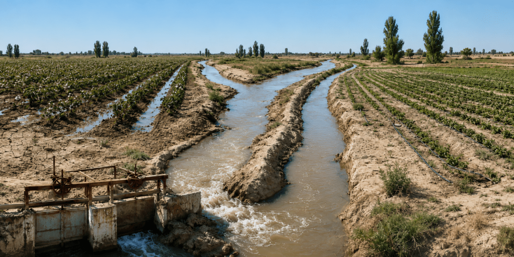
Central Asia’s water woes continue to grow worse. The water flow in the Amu Darya, one of Central Asia’s two great rivers, is slowly but significantly diminishing in Tajikistan, where the river originates. A recently released report shows the Amu Darya’s water flow in the middle and lower reaches in Tajikistan has fallen over the course of recent decades by 54-77%. And the report lays the blame firmly on human activity, not climate change. Up In the Mountains of Tajikistan The study published on ScienceDirect looked at data collected over 90 years and concludes that “streamflow decreased by 54–77% in the middle and lower reaches” of the Amu Darya in Tajikistan. Interestingly, the report mentions that precipitation in the mountains of Tajikistan has actually increased between 6 and 13%, but the Amu Darya’s water level is falling because people are using more water. The expansion of agriculture is the reason, accounting for 92% of the water reduction in Tajikistan, but the recent construction of water reservoirs is also playing a role. Lower flows of water were noted on many of the tributaries in Tajikistan that feed into the Amu Darya, including the “Vakhsh, Kunduz, Kofirnihon, Surkhandarya, Zeravshan, and Kashkadarya (rivers),” which showed streamflow reductions of 4–34%. The report said that areas in the upper reaches of the Amu Darya should see increased water levels, but this is mainly due to climate change hastening the melting of snow and glaciers. Once the glaciers are gone, the water will rapidly decrease. Bad News Downstream Water problems upstream in Tajikistan translate to bigger problems downstream in Uzbekistan and Turkmenistan. Both have already noticed a reduction in the amount of water in the Amu Darya, most visibly that the river has not reached the Aral Sea for about two decades now, contributing to the sea shrinking by some 90% since the 1960s. Every year the river recedes further south, forcing downstream communities suddenly without water to relocate. Climate change is now hastening this process in the arid, desert lands along the Uzbek-Turkmen border, but both countries are preparing for a bigger, impending shock. The Taliban started construction of the Qosh Tepa Canal in 2022, with the project scheduled to be completed in 2028. While Central Asia was liberally taking water from the Amu Darya for agricultural use, Afghanistan was in no position to claim its share until now. The canal will draw water from the Amu Darya at an area across from Uzbekistan and open up new agricultural land in northern Afghanistan, where food has long been in short supply. The 280-kilometer canal is expected to take some 16-20% of the water left in the Amu Darya after it leaves Tajikistan. Upstream Tajikistan’s falling water levels, of course, mean the Qosh Tepa Canal will also be receiving less and less water. The Combination For most of the 2020s, large areas of Central Asia have been experiencing droughts, prompting the governments there to implement water conservation measures. But as they find more ways to save...

Tajikistan Warns of Mudslides as Central Asia Expands Flood Cooperation

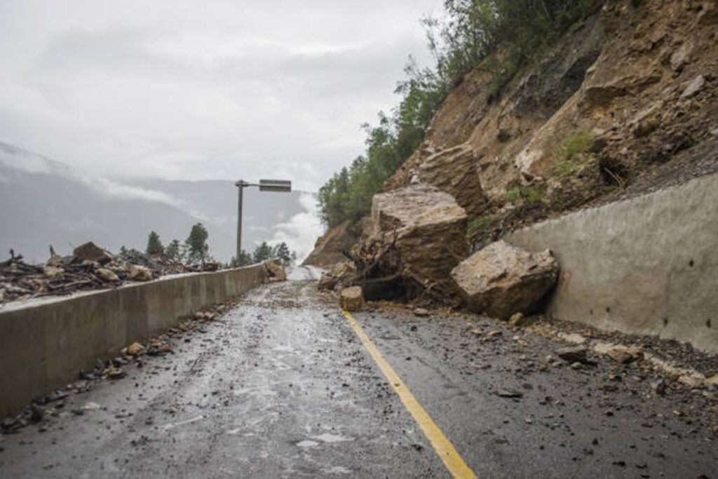
Authorities in Tajikistan say heavy rain could trigger mudslides in parts of the country in the coming days and have warned people to be extremely careful when traveling on roads near mountains and riverbanks. The warning was issued on Wednesday, days after government officials, scientists, and other delegates from across Central Asia met in Bishkek to discuss ways to address cross-border mudflows and floods. The three-day meeting, which ended on Friday, was organized by Kyrgyzstan’s Ministry of Emergency Situations and the Regional Environmental Center for Central Asia, a group that gets support from the World Bank and other international partners. Mudslides and flooding often hit parts of Central Asia in the spring and early summer, when rainfall, rising temperatures, snow and glacier melt, and increasing water levels threaten communities that scientists say are more vulnerable because of climate change. In the spring of 2024, flooding in Kazakhstan displaced thousands of people and damaged many homes and other buildings in what the government called the worst natural disaster in the country in 80 years. Central Asian governments are increasing cooperation on mitigation measures, including early warning systems, data sharing, and other projects to better protect their populations. As temperatures rise faster in Central Asia than the global average, Tajikistan is especially vulnerable because it is a mountainous country where glacier melt is a growing concern. Heavy rains and mudslides are possible through Friday, July 3, in mountainous and hilly areas across the country, as well as in Sughd Region in northwest Tajikistan, which borders Uzbekistan, and in Khatlon Region in the southwest, which borders Uzbekistan and Afghanistan, Tajikistan’s Ministry of Transport said. Citing meteorological experts, the ministry also warned of dust storms in Khatlon and the capital, Dushanbe, because of strong winds blowing from the south. “As a result of rising temperatures, glacier melt, and increasing water levels in the Panj, Vakhsh, Varzob, and Zeravshan rivers, there is a risk of mudflows in these areas,” the ministry said. It added that it had “instructed all road maintenance departments and institutions to monitor the condition of highways around the clock.” The possibility of flooding from glacier melt and rising river levels is not only a problem in mountainous areas in upstream countries such as Tajikistan and Kyrgyzstan, but also in downstream countries, including Kazakhstan, Uzbekistan and Turkmenistan, that rely on cross-border water supplies but are also vulnerable to natural disasters. Turkmenportal, an online news site, said the recent meeting in Kyrgyzstan on water cooperation in Central Asia was important to Turkmenistan because it “is located in the lower reaches of Central Asia's largest rivers and is directly dependent on the quality of transboundary cooperation in water management and flood risk reduction.”

Rats Reported at Turkmen Presidential Residence Near Ashgabat

A reported rat infestation at a Turkmen presidential residence near Ashgabat has prompted an overnight extermination operation at the compound in Archabil. According to Chronicles of Turkmenistan, sanitary workers were sent from Ashgabat to the presidential country residence on the night of June 15-16 after rats were found around the grounds. The operation reportedly lasted several hours. Pest-control teams flooded burrows and underground tunnels with water, collected the dead rats, and then treated the area with chemicals. Several carcasses were sent for laboratory testing at the Institute of Clinical Medicine and Epidemiology, housed in the former anti-plague station building. The tests reportedly found no dangerous infectious diseases. The rodents were identified as brown rats, also known as Norway rats. The species is common in urban environments and can carry diseases including leptospirosis, salmonellosis, and murine typhus. The apparent rise in rat numbers in Ashgabat and nearby areas has been linked to the regular killing of stray cats and dogs by city authorities. With fewer natural predators, they said, rats can spread more easily. Animal round-ups are a recurring feature of official preparations in Turkmenistan. In May, Turkmen.News reported that stray cats and dogs were removed from the western port city of Turkmenbashi ahead of a visit by President Serdar Berdimuhamedov. According to the outlet, this was not done subtly, with some animals “were bludgeoned to death with sticks and iron bars” in public view, including in front of children. The reported infestation is awkward for a state that presents Ashgabat and its elite residences as models of cleanliness and order. Turkmenistan’s government has not commented publicly on the incident.

Opinion: The Amu Darya Stress Test – Uzbekistan, Turkmenistan, and the Politics of Agricultural Adaptation

Central Asia’s water crisis is usually discussed as a problem of rivers, reservoirs, and diplomacy. But in 2026, the Amu Darya is also becoming something else: a test of state adaptation. The river basin entered the irrigation season under acute pressure. According to data cited by Kabar, the flow of the Amu Darya stood at only 66.8% of its normal level as of February 11, compared with 101.8% a year earlier. The Times of Central Asia previously reported that the river’s flow could fall to around 65% of its historical norm, raising risks for food security and agriculture across downstream states. Meanwhile, Afghanistan’s Qosh-Tepa Canal is advancing. The canal, one of the Taliban government’s most ambitious infrastructure projects, is designed to divert water from the Amu Darya to irrigate large areas of northern Afghanistan. Carnegie Politika has estimated that, once fully operational by 2028, it could take up to 10 cubic kilometers of water annually from the river. For Uzbekistan and Turkmenistan, the implications are direct. Both rely heavily on Amu Darya water. Both inherited agricultural systems shaped by Soviet-era irrigation, cotton production, and centralized planning, and both are now facing a combination of climate stress, upstream extraction, and aging water infrastructure. Yet their responses are increasingly different. The emerging contrast is not simply between two agricultural policies; it is between two institutional logics: adaptation and control. Uzbekistan’s Adjustment Strategy Uzbekistan is one of the most exposed countries in the region. Its population is large, its agriculture remains water-intensive, and some of its most vulnerable regions, including Khorezm and Karakalpakstan, sit near the lower reaches of the Amu Darya. For decades, the old model relied on large-scale irrigation, cotton, rice, and the assumption that water would continue to move through the regional system much as it had before. That assumption is now weakening. Tashkent’s response remains costly and far from complete. Uzbekistan still faces serious water losses, degraded land, salinization, and uneven implementation of reform. But the direction of travel is visible: the state is trying to reduce exposure by changing crops, infrastructure, and diplomatic behavior. Rice is one example. Traditional flooded rice cultivation is extremely water-intensive, and water shortages have already pushed some Uzbek rice farmers away from traditional Amu Darya regions toward areas with more stable access to water. Uzbekistan has also begun experimenting with less water-intensive methods. In Karakalpakstan, UNDP has supported the introduction of upland rice, which can reduce water consumption by up to 40% compared with traditional rice cultivation. Separately, Uzbekistan has announced plans to expand resource-efficient rice cultivation, including drip irrigation and drought-resilient rice varieties. The state is no longer treating the old water-intensive model as untouchable. In 2026, Uzbekistan allocated significant public financing for water-saving technologies. Government-linked reporting has described plans to expand drip irrigation, sprinkler systems, and laser land leveling across hundreds of thousands of hectares, with a broader target of expanding water-saving technologies to 3.5 million hectares by 2028. Laser leveling may sound technical, but its use reflects a shift from simply demanding more...

UNDP Opinion: Central Asia – Shared Wildlife, Shared Landscapes, Shared Responsibility

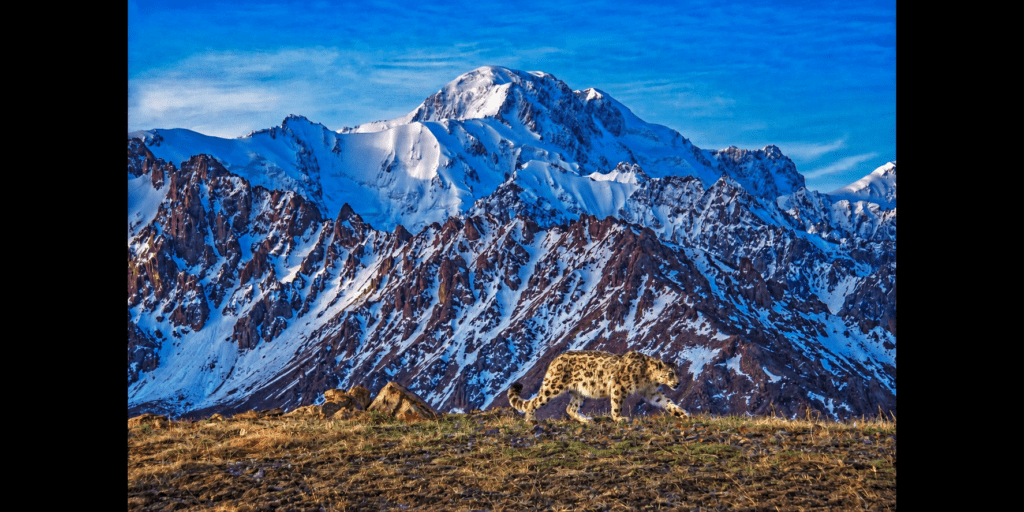
As global leaders gather for the Global Environment Facility (GEF) Assembly in Samarkand, Central Asia has an opportunity to send a clear message to the world: protecting biodiversity is not only about saving species — it is about securing water, livelihoods, resilience and long-term stability for millions of people across our region. From the glaciers of the Tien Shan and Pamir mountains to the deserts, steppes and river basins downstream, Central Asia’s ecosystems are deeply interconnected across borders. Rivers flow between countries. Wildlife migrates through shared landscapes. Mountain ecosystems regulate water systems that sustain agriculture, energy production and communities far beyond the highlands themselves. Among the most powerful symbols of this shared natural heritage is the snow leopard — the silent guardian of Central Asia’s mountains. The snow leopard represents far more than a rare and iconic species. Its survival reflects the health of entire ecosystems that millions of people depend upon every day. Healthy mountain landscapes help secure freshwater resources, reduce disaster risks, sustain pastures and agriculture, preserve biodiversity, and strengthen resilience to climate change across the region. But today, these ecosystems are under growing pressure. Climate change is accelerating glacier melting and intensifying water stress. Land degradation, unsustainable grazing, habitat fragmentation and biodiversity loss are placing increasing pressure on fragile mountain environments and rural livelihoods. Communities living closest to nature are often the first to feel the consequences — through declining water availability, degraded pastures, reduced agricultural productivity and increasing climate-related risks. These challenges do not stop at national borders. And neither can the solutions. Only a coordinated regional response can match the scale of the challenge. Protecting Central Asia’s mountain ecosystems requires countries to work together to conserve ecological corridors, strengthen transboundary protected areas, improve water and land governance, and invest in climate-resilient livelihoods for communities whose futures are closely tied to nature. There are already successful examples of regional agreements. For example, a highly successful transboundary nature conservation agreement in Central Asia protects the Ustyurt Plateau and the Turan Temperate Deserts. Spanning across Kazakhstan, Uzbekistan, and Turkmenistan, this initiative has successfully safeguarded vulnerable ecosystems and migratory species like the saiga antelope and snow leopard. [caption id="attachment_50004" align="aligncenter" width="1774"] Photo: Saiga calf. Kazakhstan/UNDP Kazakhstan[/caption] It is encouraging that transboundary cooperation has already taken shape across the region. Across Central Asia, governments, communities and development partners are already demonstrating that conservation and development can advance together. While each country's experience is unique, the lessons are remarkably similar: when communities benefit from healthy ecosystems, nature and people both thrive. In Kazakhstan, the snow leopard has become one of the clearest examples of how coordinated conservation efforts can help restore fragile ecosystems across borders. The species inhabits mountain systems that extend beyond national boundaries into China, Kyrgyzstan, Russia, and Uzbekistan, making its protection inseparable from regional cooperation. Over the past decade, habitat countries have strengthened efforts to protect the species through national conservation strategies, expanded protected areas, and improved ecosystem monitoring. Supported by cooperation between the Government, UNDP, the Global...

El Niño Could Bring Unusually Heavy Summer Rains to Central Asia, WMO Warns

Central Asia could face unusually heavy rainfall during the summer of 2026 as the climate phenomenon known as El Niño is expected to return in the coming months, according to forecasts from the United Nations’ World Meteorological Organization (WMO). The WMO estimates there is an 80% chance that El Niño conditions will develop between June and August and a near or above 90% chance that they will persist until at least November. The organization says the event could contribute to a rise in extreme weather around the world, including heatwaves, droughts, and intense rainfall. According to the WMO, temperatures in the tropical Pacific Ocean have been steadily increasing and are approaching the thresholds typically associated with El Niño. Scientists have also detected a large reservoir of unusually warm water below the ocean’s surface, with temperatures more than six degrees Celsius above normal in some areas, providing additional energy for the phenomenon to intensify. For Central Asia, El Niño is often associated with higher-than-average precipitation. While the region is better known for its arid and semi-arid climate, past El Niño events have brought increased rainfall to parts of Kazakhstan, Kyrgyzstan, Tajikistan, Turkmenistan, and Uzbekistan. WMO Secretary-General Celeste Saulo said countries should prepare for the possibility of stronger droughts and heavy rains, as well as elevated risks of heatwaves on land and in the oceans. “We need to prepare for a potentially strong El Niño event, which will exacerbate drought and heavy rainfall and increase the risk of heatwaves both on land and in the ocean,” Saulo said. UN Secretary-General António Guterres described the developing conditions as an urgent climate warning, saying El Niño would “pour fuel on the fire” of global warming and could accelerate the impacts of extreme weather worldwide. Seasonal forecasts released by the WMO also indicate that temperatures from June through August are likely to remain above normal across most regions of the world. Scientists note that while there is no evidence that climate change is making El Niño more frequent, a warmer atmosphere and warmer oceans can amplify its effects. The previous major El Niño episode, in 2023-2024, ranked among the five strongest on record and contributed to record global temperatures in 2024. The WMO says improved seasonal forecasting gives governments time to prepare for potential disruptions to agriculture, water resources, and disaster response systems before severe weather develops.