• KZT/USD = 0.00219
  • TJS/USD = 0.10810
  • UZS/USD = 0.00009
  • TMT/USD = 0.29850
  • KZT/USD = 0.00219
  • TJS/USD = 0.10810
  • UZS/USD = 0.00009
  • TMT/USD = 0.29850
  • KZT/USD = 0.00219
  • TJS/USD = 0.10810
  • UZS/USD = 0.00009
  • TMT/USD = 0.29850
  • KZT/USD = 0.00219
  • TJS/USD = 0.10810
  • UZS/USD = 0.00009
  • TMT/USD = 0.29850
  • KZT/USD = 0.00219
  • TJS/USD = 0.10810
  • UZS/USD = 0.00009
  • TMT/USD = 0.29850
  • KZT/USD = 0.00219
  • TJS/USD = 0.10810
  • UZS/USD = 0.00009
  • TMT/USD = 0.29850
  • KZT/USD = 0.00219
  • TJS/USD = 0.10810
  • UZS/USD = 0.00009
  • TMT/USD = 0.29850
  • KZT/USD = 0.00219
  • TJS/USD = 0.10810
  • UZS/USD = 0.00009
  • TMT/USD = 0.29850
06 September 2026

Viewing results 1 - 6 of 260

Kazakhstan Seeds Clouds as Kyrgyzstan Questions Regional Impact

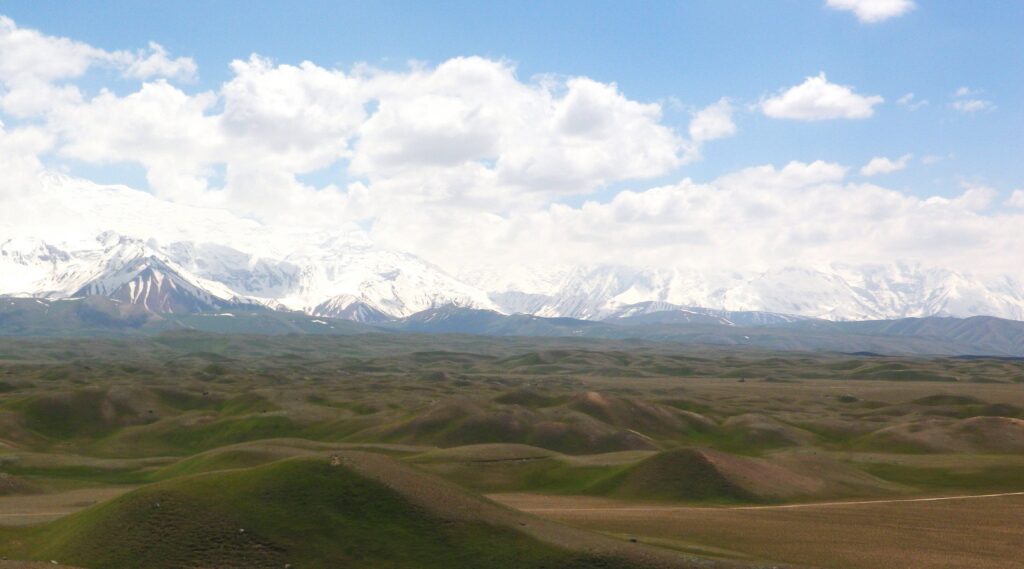
A small aircraft climbed out of Turkestan airport on July 10 with hygroscopic salt flares fixed beneath its wings. Operated by the United Arab Emirates’ National Center of Meteorology, it was searching for a cloud suitable for seeding. Pilot Ahmed Aljaberi described the aircraft as “specifically equipped with a cloud-seeding flare system.” But no suitable cloud appeared during the mission. Cloud seeding can try to draw more rain from an existing cloud, but it cannot make one from clear air. Kazakhstan launched the project in Turkestan on May 16, targeting more than 911,000 hectares of arable land in the country’s leading cotton-belt. The government puts the potential economic benefit at up to 35 billion tenge, roughly $75 million a year. The partnership gives Kazakhstan access to decades of Emirati experience in weather modification. The UAE program dates to the late 1980s, and Emirati specialists are training Kazakh meteorologists, pilots, engineers, and other staff. Kazakhstan’s government describes the Turkestan operation as the first project of its scale in the region, though weather modification in Central Asia has a longer history. Kochkunbek Bakirov, a geographer at Kyrgyzstan’s National Academy of Sciences, has described Soviet-era research in the Karshi steppe, the Naryn basin, and over Issyk-Kul. Kazakhstan also trialed a different approach in Mangystau in 2021, using an ionization-based system promoted as a way to increase rainfall. Its developer claimed the equipment had begun to influence local moisture. The Mangystau system used ionization; the current program uses aircraft and hygroscopic salt flares. Before operations began, Kazhydromet analyzed data from 39 meteorological stations covering 2020 through 2024, selecting the Turkestan Region after studying atmospheric conditions and terrain. Flights only proceed when naturally formed cumulonimbus clouds with sufficient vertical development are present, with Kazhydromet monitoring satellite imagery, synoptic data, and cloud development before operations. The aircraft releases salt-based particles into suitable clouds. Kazakhstan’s Ecology Ministry lists sodium chloride, potassium chloride, and magnesium compounds among the reagents. In hygroscopic seeding, the particles encourage liquid droplets to collide and coalesce, which can improve precipitation efficiency in a suitable cloud. The cloud and its moisture must already exist. By July 13, crews had completed eleven operational flights, mainly over the Otyrar and Sozak districts. Officials were still analyzing the results of each operation; the number of flights does not show how much extra rain the project has produced. Kazakhstan’s launch materials cite a possible 10 to 20% increase in precipitation under favorable conditions. Results elsewhere vary widely. A 2024 review by the U.S. Government Accountability Office found estimates of 0 to 20% additional precipitation in the studies it examined. The GAO also found that effectiveness remains difficult to evaluate and that suitable clouds must be present. The evidence is much stronger for some cloud-seeding methods than for others. The World Meteorological Organization (WMO) says the strongest recent causal evidence comes from wintertime glaciogenic seeding of orographic clouds, while Kazakhstan is using hygroscopic salts in convective clouds. Their large natural variability creates a weak signal-to-noise problem, making the added...
Central Asian States Plan Automated Water Monitoring on the Syr Darya

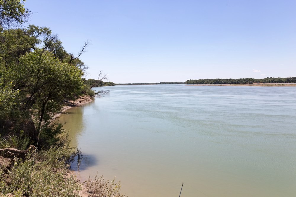
Central Asian countries have agreed to prepare a plan for automated water monitoring on the Syr Darya, one of the region’s main transboundary rivers. The system is intended to provide the countries with more accurate data on water volumes and distribution across the basin, where irrigated agriculture in several countries depends on river flows. The cost of weak coordination across Central Asia is already measured in billions: the World Bank estimates the region’s annual economic losses at more than $4.5 billion. The agreement was reached on August 7 in Turkistan, Kazakhstan. A working group to prepare the plan is expected to be established by the end of September. The decision was made at a meeting of the Interstate Commission for Water Coordination, a regional mechanism for coordinating the use of shared water resources. The Syr Darya is formed in the Ferghana Valley by the confluence of the Naryn and Kara Darya rivers, flows through Uzbekistan, Tajikistan, and Kazakhstan, and ends in the North Aral Sea. The Naryn originates in Kyrgyzstan, meaning that management of the basin involves four countries. The Syr Darya supplies major agricultural areas, while a cascade of reservoirs and hydropower plants links the distribution of river flows with electricity generation. The countries’ interests have not always coincided. In the upper reaches of the basin, water is used for hydropower generation, while farther downstream demand peaks during the summer irrigation season. Accurate monitoring and timely data exchange help countries plan water withdrawals and reservoir operations during months with the highest demand. Kazakhstan and Uzbekistan are already developing part of the future system. The two countries are automating ten hydrological monitoring stations on the Syr Darya, five on each side of the border. Sensors are expected to record water flow and transmit the data online. At the meeting in Turkistan, the two sides agreed to accelerate efforts to secure grant financing and consider expanding the system to other parts of the basin. Kazakhstan already has experience with automated monitoring. On parts of its irrigation network, sensors remotely transmit data on water levels and pressure. Over the past decade, more than 800 kilometers of lined canals have also been rehabilitated in four regions, while irrigation system upgrades have covered more than 100,000 hectares of farmland. Uzbekistan is also seeking to reduce irrigation losses. Agriculture accounts for about 90% of the country’s water consumption. One project provides for the reconstruction of 259 kilometers of major canals and the installation of automated water-flow monitoring systems. The World Bank estimates the expected water savings at around 540 million cubic meters a year. The current season on the Kazakh section of the Syr Darya has so far been favorable. Since April 1, around three billion cubic meters of water have flowed into the Shardara Reservoir in southern Kazakhstan. This volume is higher than both last year’s figure and the long-term average. The region received additional funding for water projects in July. The World Bank allocated a $20 million grant to improve the management of...

Kyrgyzstan’s Issyk-Kul Glaciers Have Lost One-Third of Their Area

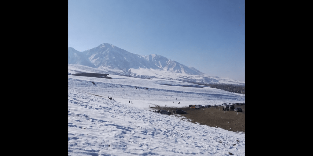
Glacier coverage in the Issyk-Kul Basin has shrunk by 33.7% compared with records from 70–90 years ago, according to an updated inventory released by Kyrgyzhydromet, the Hydrometeorological Service under Kyrgyzstan’s Ministry of Emergency Situations. The service said coverage had declined by 23.1% over the past 7–10 years, indicating that the retreat has accelerated. The revised inventory was compiled using Copernicus Sentinel-2 satellite imagery, Google Earth, QGIS, and earlier glacier catalogs. Researchers refined glacier boundaries, documented fragmentation, and identified glaciers that had disappeared. Kyrgyzhydromet attributed the decline to climate change and said the new inventory would provide a baseline for assessing the country’s long-term water resources. The retreat has implications for Lake Issyk-Kul, which is fed by rivers originating in the surrounding mountains. The 2018 Catalogue of Glaciers of Kyrgyzstan, based on Landsat 8 imagery from 2013–2016, recorded 957 glaciers covering 560.8 square kilometers in the Issyk-Kul Basin. About 118 rivers and streams flow into the lake, many supplied by snow and glacial melt. Between 1927 and 2003, the lake’s water level fell by 2.75 meters. Continued glacier loss could reduce river inflows and increase pressure on agriculture and tourism, both of which depend heavily on the basin’s water resources. In December 2025, the Cabinet of Ministers approved the Concept for the Sustainable Development of the Ecological and Economic System of Lake Issyk-Kul through 2030, along with an action plan. The measures include modernizing irrigation infrastructure and expanding the use of water-saving technologies, supported by concessional financing for farmers. Kyrgyzstan is also preparing a feasibility study for an integrated national cryosphere monitoring system. The proposed system would combine monitoring of glaciers and snow cover with other parts of the cryosphere. The new inventory provides a more recent basis for that work and for future water management and climate risk assessments.

Kyrgyzstan Links Record Heatwave to Accelerating Glacier Retreat

Kyrgyzstan's state weather agency, Kyrgyzhydromet, has warned that last month's record-breaking heatwave is the latest sign of climate change accelerating the retreat of the country's glaciers, threatening water supplies across Central Asia. The agency said the immediate heatwave was caused by regional atmospheric conditions, but its director, Daurbek Sakeyev, argued that the growing frequency of such extreme weather reflected a longer-term warming trend already affecting mountain ecosystems and water resources. Abnormally hot weather settled over Kyrgyzstan on July 14. Meteorologists attributed it to a combination of a summer thermal depression over Central Asia and a persistent area of high pressure in the upper atmosphere. The country saw consecutive days with temperatures exceeding 40°C. In Bishkek, the temperature reached 43.5°C on July 19, the highest July reading in the capital since observations began in 1936. Bishkek recorded no measurable rainfall during the month, while average daily temperatures on July 18 and 19 stood nearly 10°C above the seasonal norm. Record electricity demand prompted temporary supply restrictions in Bishkek and the surrounding Chuy Region, although a separate widespread outage on July 17 was attributed to the emergency disconnection of two 220-kilovolt transmission lines. Speaking after the heatwave had subsided, Sakeyev said spring was arriving earlier, summers were becoming hotter, and winters were bringing less precipitation, changes that were affecting the condition of the country’s glaciers. Earlier spring warming lengthens the annual melting season, while prolonged periods of extreme summer heat accelerate ice loss. Reduced winter snowfall also limits the accumulation of new ice and exposes darker glacier surfaces earlier, causing them to absorb more solar energy. According to Kyrgyzhydromet, Kyrgyzstan’s glaciers have lost around 16% of their total area over the past 70 years. Recent monitoring places the decline in the Talas Valley at 22%. Smaller, lower-altitude glaciers are particularly vulnerable, and scientists expect their number and area to decline substantially by 2050. Separately, Kyrgyzhydromet reported on July 30 that glacier area in the Issyk-Kul basin had declined by 33.7% over 70 to 90 years and by 23.1% over the most recent seven to ten years. The consequences extend beyond Kyrgyzstan. Tien Shan glaciers feed the Syr Darya, Chu, Talas, and Ili river systems, supplying water for millions of people, irrigation, and hydropower. Continued glacier retreat could alter seasonal flows and increase the risk of glacial lake outburst floods threatening mountain communities. Glacier retreat is one of Central Asia’s most significant long-term challenges. The region’s water security will depend on precipitation, seasonal snow cover, glacier loss, and governments’ ability to store and manage increasingly variable river flows.

Kyrgyzstan Hazardous Waste Cleanup Begins at Soviet Era Kristall Plant

Kyrgyzstan has launched a project with Russia's state nuclear corporation Rosatom to eliminate hazardous chemical waste stored for decades at the former Kristall industrial plant, one of the country's most dangerous Soviet-era environmental sites. Located in Tash-Kumyr in Jalal-Abad Region, the Kristall plant was intended to become one of the Soviet Union’s largest producers of high-purity silicon, a material used in microchips and, more recently, solar panels. Construction began in 1982 and the site was commissioned in 1989, but was never completed at its planned scale. Rising energy costs and the economic disruption that followed the collapse of the Soviet Union left the plant uncompetitive. Several attempts were made to revive production, although it never returned to full industrial operation and was declared bankrupt in 2010. The Kyrgyz Ministry of Natural Resources estimates that around 80 metric tons of toxic chemicals remain at the site. A more detailed Rosatom audit identified as much as 155 metric tons of confirmed or suspected chemical residues. For more than 15 years, the stockpile has been regarded as a potential environmental and public health risk. Both chemicals react rapidly with water or moisture in the air, producing heat and corrosive hydrogen chloride fumes. Exposure to the substances or their vapors can cause severe burns to the skin and eyes, damage the respiratory system, and, at high concentrations, cause potentially fatal lung injuries. According to the Ministry of Natural Resources, the chemicals are stored in specially designed metal containers that have gradually deteriorated after years without maintenance, increasing the risk of leaks. A technical assessment conducted by specialists from Rosatom in October 2024 confirmed the advanced deterioration of the storage infrastructure. It found that natural corrosion and decades of inactivity had increased the risk of tanks losing their seals or collapsing. Practical disposal work is scheduled to begin in November 2026. The operation has been planned for the colder months because lower temperatures reduce the danger of uncontrolled evaporation, fire, or chemical releases when the tanks are opened. The authorities expect the hazardous chemicals to be fully neutralized and the site brought to an environmentally safe condition by 2027. The Kyrgyz Ministry of Emergency Situations has valued its contract with Rosatom at 321.6 million rubles (approximately US$4.1 million). Although Kyrgyz officials previously said they were discussing possible Russian financing, the ministry later stated that the work would be paid for through Kyrgyzstan’s state budget. The project forms part of Kyrgyzstan’s broader effort to address the country’s Soviet-era environmental legacy. Rosatom has also helped clean up five former uranium sites at Min-Kush and Kaji-Sai, relocating large volumes of radioactive waste and restoring contaminated land over a nine-year period. Russia covered approximately 75% of the cost of that separate program. The Times of Central Asia previously reported that Bishkek had begun developing a unified long-term monitoring system for former uranium mining and waste sites to oversee their condition after remediation work is completed. Kristall presents a different type of danger because its waste is chemical rather than radioactive. Its history nevertheless...

Kyrgyzstan Records 348 Mudflows in Six Months, Highest Total in Decades

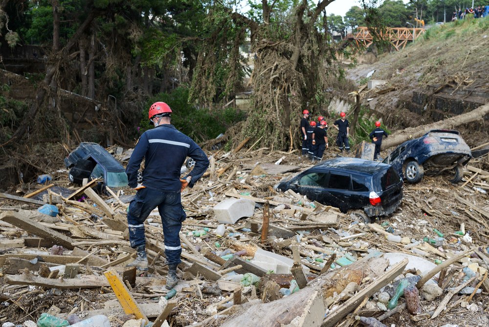
Kyrgyzstan recorded 348 mudflows during the first half of 2026, the highest number in 30 to 40 years, according to the Ministry of Emergency Situations and Kyrgyzhydromet. These violent torrents of water, mud, and boulders killed eight people and injured three. Roads, villages, and critical infrastructure are concentrated in narrow mountain valleys. Each new debris flow can therefore threaten lives and isolate entire communities. A Rapidly Escalating Season The damage extends beyond the human toll. Authorities evacuated 236 people from hazardous areas, while mudflows damaged 668 hectares of farmland. Preliminary estimates place economic losses at 399 million soms (approximately $4,560,000). The scale of the crisis became apparent well before mid-summer. By late June, Kyrgyzstan had already recorded more than 240 mudflows. The first-half total of 348 was almost five times the roughly 70 recorded during the same period of 2025. The deadliest incident occurred on the Osh-Alay highway, where a powerful mudflow swept a vehicle from the road, killing six people. The Ministry of Emergency Situations identifies Batken, Jalal-Abad, Osh, and Talas regions as the country’s most vulnerable areas, where mudflows repeatedly destroy roads, bridges, and residential buildings. Why the Risk Is Increasing Officials link the surge to several overlapping factors, including intense local downpours and earlier snow and glacier melt. Settlement expansion into hazardous valleys and a shortage of protective structures have increased exposure. Pasture degradation and forest loss add to the danger. Rising temperatures are also transforming the Tian Shan as glaciers retreat and new high-altitude lakes emerge. Kyrgyzhydromet estimates that the area of Kyrgyzstan’s glaciers has declined by about 16% in recent decades. As glaciers shrink, newly formed alpine lakes become more vulnerable to overflowing or bursting during intense rainfall or rapid snow and ice melt. Such outbursts can generate destructive debris flows. The threat extends beyond mudflows. Officials warn that warming will also increase the risks posed by glacial-lake outbursts, landslides, and rockfalls. Strengthening Defenses Despite the record number of mudflows, the death toll remains significantly lower than in 2024, when such disasters claimed 25 lives. The Ministry of Emergency Situations attributes the improvement to earlier warnings, more effective evacuations, and expanded preventive measures in high-risk areas. Kyrgyzstan is also expanding its use of forecasting technologies. KG Labs, working with international partners, is developing an AI model to forecast glacial lake outburst floods in the Tian Shan. The work draws on a digital catalogue of Kyrgyzstan’s glaciers and is exploring affordable sensors for remote mountain areas with intermittent internet access. The Ministry of Emergency Situations already uses a separate AI-powered system to monitor high-altitude lakes and issue warnings. The Season Is Far From Over The figure of 348 covers only the first six months. In Kyrgyzstan, the period of highest risk typically lasts until autumn, meaning that mountain communities and transport corridors remain vulnerable for several more months. The events of 2026 illustrate how rapidly natural hazards are evolving. Retreating glaciers, the formation of new alpine lakes, and increasingly intense rainfall are changing the country’s risk...