• KZT/USD = 0.00223
  • TJS/USD = 0.10800
  • UZS/USD = 0.00009
  • TMT/USD = 0.29760
  • KZT/USD = 0.00223
  • TJS/USD = 0.10800
  • UZS/USD = 0.00009
  • TMT/USD = 0.29760
  • KZT/USD = 0.00223
  • TJS/USD = 0.10800
  • UZS/USD = 0.00009
  • TMT/USD = 0.29760
  • KZT/USD = 0.00223
  • TJS/USD = 0.10800
  • UZS/USD = 0.00009
  • TMT/USD = 0.29760
  • KZT/USD = 0.00223
  • TJS/USD = 0.10800
  • UZS/USD = 0.00009
  • TMT/USD = 0.29760
  • KZT/USD = 0.00223
  • TJS/USD = 0.10800
  • UZS/USD = 0.00009
  • TMT/USD = 0.29760
  • KZT/USD = 0.00223
  • TJS/USD = 0.10800
  • UZS/USD = 0.00009
  • TMT/USD = 0.29760
  • KZT/USD = 0.00223
  • TJS/USD = 0.10800
  • UZS/USD = 0.00009
  • TMT/USD = 0.29760
20 September 2026

Viewing results 1 - 6 of 149

Central Asia Makes Progress on Uranium Cleanup, but Major Risks Remain

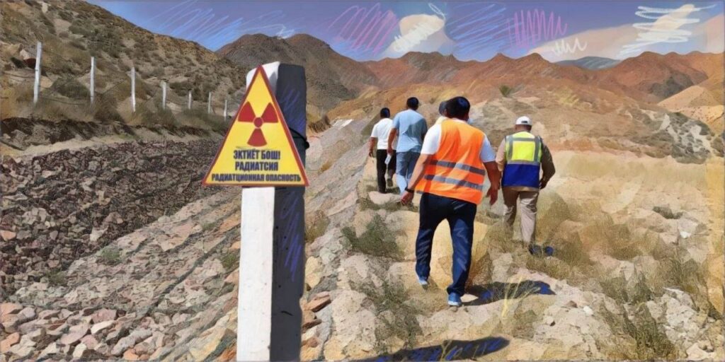
Radioactive waste lies beside the river in Mailuu-Suu, a former uranium town in Kyrgyzstan’s picturesque mountain landscape. Engineers preparing to secure it found a problem inside one of its dams. Additional drilling revealed tailings within the dam structure itself. Two subsequent studies concluded that waste from two connected ponds would have to be moved to a safer location. The discovery changed the cleanup design and increased its cost, according to the International Atomic Energy Agency’s revised master plan. Material that planners had intended to secure in place could no longer safely remain there. Once known as Mailbox 200, the town was founded in 1946 for a secret Soviet uranium program. Its workforce included Germans treated as politically suspect and former Red Army soldiers punished for surrendering during World War II. Uranium mining and processing at Mailuu-Suu ended in the late 1960s, leaving waste buried along the river. Cleanup is expected to continue until 2032. Even then, the authorities will need to maintain the restored sites and check that contamination remains contained. Mailuu-Suu illustrates why Central Asia’s uranium cleanup has stretched across decades. The waste sits in places where rivers and unstable slopes can carry it beyond the original industrial sites. Making those places safer requires extensive engineering, followed by public oversight that must outlast the contractors. [caption id="attachment_56370" align="aligncenter" width="1774"] Archival photograph of Mailuu-Suu’s old mill and uranium tailings; image: Peter Waggit/IAEA[/caption] The International Atomic Energy Agency’s latest assessment, published in January 2026, records substantial progress. Four out of seven priority sites have been remediated since the original regional plan was adopted in 2017. But Mailuu-Suu remains one of the largest and most complex projects, with work expected to extend beyond the updated regional plan’s 2030 horizon. Across the region, former uranium operations left radioactive residue after mining and processing ended. The IAEA describes facilities abandoned without adequate plans for safe closure. National governments inherited responsibility for sites where no private owner remained to pay for the work. The geography compounds the situation. The IAEA’s original planning framework identifies tailings ponds near major rivers in seismically active areas. Flooding or a landslide can undermine containment and lead to contaminated materials traveling downstream. The location of a deposit therefore helps determine the urgency and design of its cleanup. At Mailuu-Suu, the European Bank for Reconstruction and Development (EBRD) announced a €23 million grant in 2023. The original design included soil covers two meters thick to reduce water entering the waste and prevent access to it. The project concerned more than two million cubic meters of tailings along the river and its tributaries. Following the devastating 2023 earthquake in Turkey and Syria, Kyrgyzstan’s Ministry of Construction required further checks on the dams’ stability. Drilling revealed tailings inside the dam at pond seven. Subsequent studies found that the waste in ponds five and seven could not safely remain in place. The IAEA plan warns that a strong earthquake could cause the dam to collapse, allowing water-saturated waste to liquefy and enter the river....

Tajikistan Turns to Early Warning Systems as Climate Risks Grow

On the evening of May 1, a mudflow swept into residential neighborhoods in Kulob, southern Tajikistan. When water flooded a neighboring house, Mirzo Muloniezov rushed inside and managed to carry out his two-year-old grandson. The water had already reached the electrical outlets. Muloniezov was electrocuted. Neighbors pulled him from the water, but he could not be saved. In the first six months of 2026, Tajik authorities recorded 741 natural emergencies. Avalanches accounted for 508 of them, while another 123 were mudflows. Twelve people were killed, and economic damage exceeded TJS 52.8 million – about $5.7 million. Dushanbe is now discussing with the United Kingdom technologies that could give people more time before disaster strikes. On September 14, Rajabali Rahmonali, chairman of Tajikistan’s Committee for Emergency Situations and Civil Defense, met British Ambassador Katherine Smitton. Along with training rescuers and holding joint exercises, the talks covered geographic information systems (GIS), risk mapping, drones, remote monitoring, and early warning systems. These are no longer technologies for some distant future. Drones and GIS are already being used to monitor glaciers and areas exposed to mudflows. In late August, scientists from the Research Center for Ecology and Environment of Central Asia surveyed the Megdor and Khirson glaciers in the Vanjob River basin. They combined aerial surveys using drones with satellite imagery, GIS data, and hydrometeorological observations. The data allow specialists to track glacier movement and areas where new hazards could emerge. During the expedition, they also surveyed the area around the village of Votkhud after a July 19 mudflow damaged water supply and irrigation infrastructure. Particular attention is being paid to the Khirson Glacier. Its sudden surges have previously blocked river channels and created glacial lakes. Such lakes can become dangerous if a natural ice or debris dam fails, sending large volumes of water crashing into the valley below. Some early warning infrastructure is already operating in the country. In June, Tajikistan’s Agency for Hydrometeorology reported the deployment of systems used for flood forecasting and early warning. Tajikistan is also rehabilitating hydrological stations and expanding its observation network. British assistance is therefore being discussed for a system that already has some of its components in place. What remains unclear is whether the cooperation will provide additional monitoring stations, drones, software, specialist training, or a combination of these – and where any new equipment or systems would operate. Kulob shows what the existing system still lacks. Heavy rains in early May triggered floods and landslides in several parts of the country. Three people died – two were trapped beneath collapsed walls, and Muloniezov was electrocuted. His son Muloniezov Yakubchon told Asia-Plus that the mudflow arrived at around 8 p.m. Water first entered a neighboring house where children were inside, and then destroyed his family’s fence. After his father’s death, the family temporarily moved in with relatives. By May 20, 520 affected families in Kulob had received government assistance, while another 330 were still waiting. Umeda Alimova, a resident of the Qurbon Zardak neighborhood, received flour,...

Water in Central Asia: Can the Five States Reach an Agreement?

Central Asia is entering a period of growing water stress, as climate change makes supplies less predictable while demand continues to rise. Populations are growing, economies require new energy and industrial capacity, glaciers are shrinking, and agriculture continues to consume most of the available water. The region’s two main rivers – the Amu Darya and Syr Darya – cross national borders, making it impossible for any one country to solve the problem on its own. After decades of disputes, Central Asian states are increasingly trying to manage water jointly. In 2026, that cooperation has produced further practical steps, from plans for automated water accounting in the Syr Darya basin to new proposals for reforming regional mechanisms. The question now is whether the five countries can agree on rules when their water needs remain different. Water and Energy: An Old Conflict The structural conflict is rooted in the region’s geography. Kyrgyzstan and Tajikistan are upstream states and use water in part for hydropower generation, particularly in winter. Kazakhstan, Uzbekistan, and Turkmenistan are downstream and need large volumes in summer during the irrigation season. During the Soviet period, a centralized exchange system was in place: upstream republics stored water in winter and released it in summer, receiving energy resources in return. After the collapse of the Soviet Union, that unified mechanism disappeared. Interstate agreements preserved a degree of coordination but did not eliminate the tension between upstream energy needs and downstream agricultural interests. Climate change is now adding another layer to the problem. Retreating glaciers in the Pamir and Tien Shan mountains are altering the timing and reliability of river flows, while populations and consumption are increasing. Countries across the region are planning new power plants, industrial facilities, mining projects, and data centers, while agriculture remains the largest consumer of water. From Seasonal Quotas to Joint Management The main formal mechanism for coordinating river allocations remains the Interstate Commission for Water Coordination of Central Asia (ICWC), established in 1992. Through it, countries coordinate water withdrawal limits and reservoir operating regimes in the Amu Darya and Syr Darya basins. In late 2025, the countries agreed on water allocations for 2026: for the Amu Darya, the total withdrawal limit for the water-management year from October 2025 to October 2026 was around 55.4 billion cubic meters, while the Syr Darya allocation for the non-growing season was approximately 4.2 billion cubic meters. The five-state framework does not, however, cover every major user of the Amu Darya. Afghanistan is outside the regional allocation system, while its Qosh Tepa Canal, now under construction, has added another source of uncertainty over future downstream flows. Such agreements keep the shared system functioning, but many decisions are still made ahead of each new season. Climate change and rising demand require a longer-term model. In February of this year, Kazakhstan proposed developing a Central Asian Framework Convention on Water Use, while joint infrastructure projects, including Kyrgyzstan’s Kambarata-1 hydropower plant with the participation of Kazakhstan and Uzbekistan, are gradually adding shared economic interests...

Tajikistan Glacier Mudflows Warning Issued as Climate Risks Grow

Tajikistan’s government is warning people in several mountainous regions about the threat of “localized and glacial mudflows” in the next few days, highlighting the hazards faced by some communities in a country where glaciers are becoming increasingly vulnerable to climate change. The warning comes days after a landslide and the collapse of part of a glacier set off catastrophic flooding in Nepal that, according to the official figures on Tuesday, killed more than 1,000 people and left about 4,000 people missing. While the likelihood of a similar event occurring in Tajikistan is difficult to gauge, authorities there are aware of the instability of ice formations in some high-altitude areas and are working with international help to improve monitoring systems. The government’s current warning extends from September 2 to September 4, covering parts of the Districts of Republican Subordination, extending east and north of Dushanbe; the Sughd region, which is further north of the capital; and western parts of the Gorno-Badakhshan Autonomous Region, which covers nearly all of eastern Tajikistan. “Citizens are advised to take precautions against the effects of changing weather conditions,” warned the hydrometeorology agency of the state Committee for Environmental Protection. The hydrometeorology agency, which monitors weather and water, hosted a workshop on August 21 for state scientists and other specialists to learn about an automated tool that can potentially identify emerging lakes in some glacier basins in Central Asia, helping to assess the threat of possible flooding. The tool, which is called Transient Hydrologic Anomalies Weekly, or THAW, uses satellite data and the Google Earth Engine platform to monitor bodies of water. “The tool can draw attention to a potential outburst-hazard and can support the timely identification of lakes requiring further monitoring,” the Tajik agency said in a report on the workshop. The event was jointly organized with the UNESCO regional office in Almaty, Kazakhstan, and the University of Zurich in Switzerland as part of a regional initiative called Glacier Lake Outburst Floods in Central Asia, or GLOFCA. The threat of flooding from a glacial lake is a different hazard from the sudden collapse of rock and glacial ice that occurred in Nepal. But GLOFCA warns that Central Asia’s glaciers are shrinking at a rate of 0.2–1% per year by volume, increasing the possibility of unstable glacial lakes and related flooding. While many mountainous areas are sparsely populated, experts are concerned about the impact of flooding on vulnerable communities living downstream. GLOFCA says more than 1,000 “high-risk” lakes have been identified in Central Asia, and encourages regional collaboration on monitoring systems. The initiative supports the implementation of early warning systems not only in Tajikistan, but also Kazakhstan, Kyrgyzstan, and Uzbekistan. Tajikistan has more than 60 per cent of Central Asia’s glaciers, covering about 6 percent of the country and providing fresh water to the region, according to the United Nations Development Programme. However, many glaciers in Tajikistan have disappeared in recent decades and rising temperatures threaten many more, posing the threat to mountain communities of “floods, landslides,...

UN Desertification Forum Highlights Central Asian Land Degradation

Mongolia is hosting a United Nations (UN) conference on combating desertification this month, with delegates from Central Asian countries discussing cooperation on the challenges of climate change, water scarcity, and sustaining vast ecosystems such as the Eurasian steppes. Bakhodur Sheralizoda, chairman of Tajikistan’s Committee for Environmental Protection, was among speakers appealing for more regional and international cooperation in the face of land degradation, desertification, and drought. While the meeting in Ulaanbaatar is aimed at the protection of rangeland and grassland ecosystems, Sheralizoda also noted the importance of preserving mountain ecosystems such as those that cover most of Tajikistan’s territory. He said Tajikistan is one of Central Asia's major sources of water and protecting its glaciers is therefore critical, Khovar, Tajikistan’s state news agency, reported on Monday. His comments highlighted the interconnectedness of the environmental challenges being discussed at the UN Convention to Combat Desertification, which started on August 17 and ends on August 28. The conference is focusing on “the arid, semi-arid and dry sub-humid areas, known as the drylands, where some of the most vulnerable ecosystems and peoples can be found,” according to organizers. The goal of the meeting is to promote sustainable rangeland management, climate-resilient land use, and land restoration across those fragile areas. Nearly 77% of Mongolia’s land is already degraded, and limited rainfall and short growing seasons make recovery from degradation difficult, according to the UN. More than 80 million hectares in Central Asia, or an area about four times the size of Kyrgyzstan, are already degraded, the UN says. Along with Tajikistan, the Central Asian countries of Kazakhstan, Kyrgyzstan, Turkmenistan, and Uzbekistan have been working on ways of mitigating threats to ecosystems, including soil protection and monitoring, drip irrigation, and the planting of seedlings. Late last year, Uzbekistan hosted a major international conference on wildlife trade, held under the UN-linked Convention on International Trade in Endangered Species, as countries and international institutions look for ways to counter global conservation pressures. In a commentary on PBS, Dr. Justine Shanti Alexander, Mongolia director for the New York-based Wildlife Conservation Society, said the hosting of the UN event in Ulaanbaatar “provides a unique opportunity to showcase to the world how healthy, high integrity rangelands underpin wildlife, pastoral livelihoods, and climate resilience.”

Central Asian States Plan Automated Water Monitoring on the Syr Darya

Central Asian countries have agreed to prepare a plan for automated water monitoring on the Syr Darya, one of the region’s main transboundary rivers. The system is intended to provide the countries with more accurate data on water volumes and distribution across the basin, where irrigated agriculture in several countries depends on river flows. The cost of weak coordination across Central Asia is already measured in billions: the World Bank estimates the region’s annual economic losses at more than $4.5 billion. The agreement was reached on August 7 in Turkistan, Kazakhstan. A working group to prepare the plan is expected to be established by the end of September. The decision was made at a meeting of the Interstate Commission for Water Coordination, a regional mechanism for coordinating the use of shared water resources. The Syr Darya is formed in the Ferghana Valley by the confluence of the Naryn and Kara Darya rivers, flows through Uzbekistan, Tajikistan, and Kazakhstan, and ends in the North Aral Sea. The Naryn originates in Kyrgyzstan, meaning that management of the basin involves four countries. The Syr Darya supplies major agricultural areas, while a cascade of reservoirs and hydropower plants links the distribution of river flows with electricity generation. The countries’ interests have not always coincided. In the upper reaches of the basin, water is used for hydropower generation, while farther downstream demand peaks during the summer irrigation season. Accurate monitoring and timely data exchange help countries plan water withdrawals and reservoir operations during months with the highest demand. Kazakhstan and Uzbekistan are already developing part of the future system. The two countries are automating ten hydrological monitoring stations on the Syr Darya, five on each side of the border. Sensors are expected to record water flow and transmit the data online. At the meeting in Turkistan, the two sides agreed to accelerate efforts to secure grant financing and consider expanding the system to other parts of the basin. Kazakhstan already has experience with automated monitoring. On parts of its irrigation network, sensors remotely transmit data on water levels and pressure. Over the past decade, more than 800 kilometers of lined canals have also been rehabilitated in four regions, while irrigation system upgrades have covered more than 100,000 hectares of farmland. Uzbekistan is also seeking to reduce irrigation losses. Agriculture accounts for about 90% of the country’s water consumption. One project provides for the reconstruction of 259 kilometers of major canals and the installation of automated water-flow monitoring systems. The World Bank estimates the expected water savings at around 540 million cubic meters a year. The current season on the Kazakh section of the Syr Darya has so far been favorable. Since April 1, around three billion cubic meters of water have flowed into the Shardara Reservoir in southern Kazakhstan. This volume is higher than both last year’s figure and the long-term average. The region received additional funding for water projects in July. The World Bank allocated a $20 million grant to improve the management of...