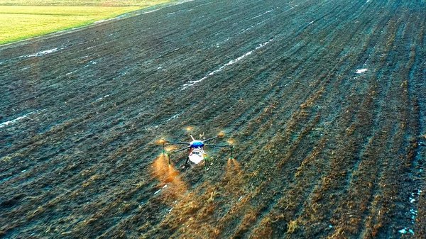
Researchers at Sarsen Amanzholov University in Ust-Kamenogorsk, East Kazakhstan, have developed a digital system that integrates drone imagery with artificial intelligence (AI) to assess soil quality and crop health with high precision.
The system enables farmers to monitor soil and plant conditions in ways previously inaccessible. Drones equipped with multispectral cameras capture images across five spectral bands: red, blue, green, near-infrared, and mid-infrared.
“This approach makes it possible to ‘see’ what is invisible to the human eye, soil moisture levels, chlorophyll content, early signs of plant disease, or land degradation,” said Almasbek Maulit, a researcher at Sarsen Amanzholov University. “AI algorithms analyze the images, differentiate between crops and weeds, identify patterns of spread, and even generate automatic maps of infected areas. This enables farmers to take targeted action from local treatment of problem zones to adjusting crop rotation or cultivation methods.”
The system offers several key benefits:
- Optimized use of fertilizers and plant protection products, reducing costs
- Early detection of problems, minimizing crop losses
- Improved profitability through better sowing and crop management strategies
- Reliable land quality assessments for investors and state authorities
The project is part of Kazakhstan’s broader strategy to integrate high-tech solutions into agriculture, a sector that remains a cornerstone of the national economy. Earlier this year, The Times of Central Asia reported that engineers in Karaganda unveiled prototypes of drones designed for public safety applications.
By merging AI with drone-based imaging, scientists in East Kazakhstan are helping to position the country’s agribusiness sector for smarter, more sustainable practices and long-term growth.