• KGS/USD = 0.01149 0%
  • KZT/USD = 0.00191 0%
  • TJS/USD = 0.09217 0.44%
  • UZS/USD = 0.00008 0%
  • TMT/USD = 0.28615 0%
  • KGS/USD = 0.01149 0%
  • KZT/USD = 0.00191 0%
  • TJS/USD = 0.09217 0.44%
  • UZS/USD = 0.00008 0%
  • TMT/USD = 0.28615 0%
  • KGS/USD = 0.01149 0%
  • KZT/USD = 0.00191 0%
  • TJS/USD = 0.09217 0.44%
  • UZS/USD = 0.00008 0%
  • TMT/USD = 0.28615 0%
  • KGS/USD = 0.01149 0%
  • KZT/USD = 0.00191 0%
  • TJS/USD = 0.09217 0.44%
  • UZS/USD = 0.00008 0%
  • TMT/USD = 0.28615 0%
  • KGS/USD = 0.01149 0%
  • KZT/USD = 0.00191 0%
  • TJS/USD = 0.09217 0.44%
  • UZS/USD = 0.00008 0%
  • TMT/USD = 0.28615 0%
  • KGS/USD = 0.01149 0%
  • KZT/USD = 0.00191 0%
  • TJS/USD = 0.09217 0.44%
  • UZS/USD = 0.00008 0%
  • TMT/USD = 0.28615 0%
  • KGS/USD = 0.01149 0%
  • KZT/USD = 0.00191 0%
  • TJS/USD = 0.09217 0.44%
  • UZS/USD = 0.00008 0%
  • TMT/USD = 0.28615 0%
  • KGS/USD = 0.01149 0%
  • KZT/USD = 0.00191 0%
  • TJS/USD = 0.09217 0.44%
  • UZS/USD = 0.00008 0%
  • TMT/USD = 0.28615 0%
22 December 2024

Viewing results 13 - 18 of 35

Countries of Central Asia Team up as Threat of Natural Disasters Grows

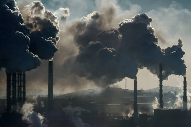
Central Asia is vulnerable to a panoply of natural hazards: Floods, landslides, droughts, sandstorms, avalanches and earthquakes. Countries in the region increasingly seek to collaborate on early warning systems and other emergency precautions, especially since disasters can spill across borders and because the effects of climate change are intensifying. To that end, the heads of the national emergency departments of Kyrgyzstan, Kazakhstan, Tajikistan and Uzbekistan met last week in Cholpon-Ata, a lakeside resort town in northern Kyrgyzstan whose attractions include ancient petroglyphs showing deer, leopards and hunting scenes. Turkmenistan´s flag – green expanse, red stripe with designs and white crescent and stars - was on display in the conference hall, though official announcements did not mention the presence of any delegation from the reclusive Turkmen government. The goal was to share information and experience, and deepen cooperation among the emergency agencies of those Central Asian countries, said Maj. Gen. Boobek Azhikeev, Kyrgyzstan’s minister of emergency situations. The five nations, which have a total of approximately 75 million people and encompass four million square kilometers, face growing risks from natural disasters, and the region has been warming faster than the global average according to a report released in May by the U.N. agency for the coordination of disaster risk reduction and the U.N. Development Programme. The two U.N. bodies, which helped to support the Central Asia meeting on the shores of Kyrgyzstan’s Lake Issyk-Kul on Aug. 15, also mentioned human-made hazards, such as industrial accidents, chemical waste facilities in densely populated areas, and severe air pollution in major cities in all the countries. “Many disaster risk management systems are still reactive, not proactive. Early warning processes are often fragmented, and poorly integrated into countries' development strategies and policies for risk-informed decision-making,” the U.N. agencies said. “There is a lack of anticipation of new and emerging risks, insufficient monitoring and forecasting, and limited financial and technological support. Early warning communication and dissemination are often unclear, especially for the most vulnerable.” The private sector and media can also get more involved in ways of reducing the risk from disasters, they said. The U.N. agencies also noted progress, saying Tajikistan had taken the lead in Central Asia in rolling out an early warning system focused on monitoring, forecasting, communication and other measures. Earlier this month TCA reported that the head of Tajikistan’s committee for emergency situations and civil defense, Rustam Nazarzada, stated that the economic damage caused by natural disasters in the country has amounted to over $12 million in this year alone. Additionally, Uzbekistan is updating an early warning system in the populous, economically important Ferghana valley that will promptly disseminate weather forecasts. Central Asian countries have sought to coordinate on environmental issues in the past, sometimes with mixed results. But the sense of urgency is growing. Earlier this year, Kyrgyzstan was among countries that sent aid to Kazakhstan after floods there that the Kazakh president described as the worst natural disaster in 80 years. Kazakhstan, in turn, sent tons of humanitarian aid to Kyrgyzstan after...

Can the Aral Sea Be Saved?

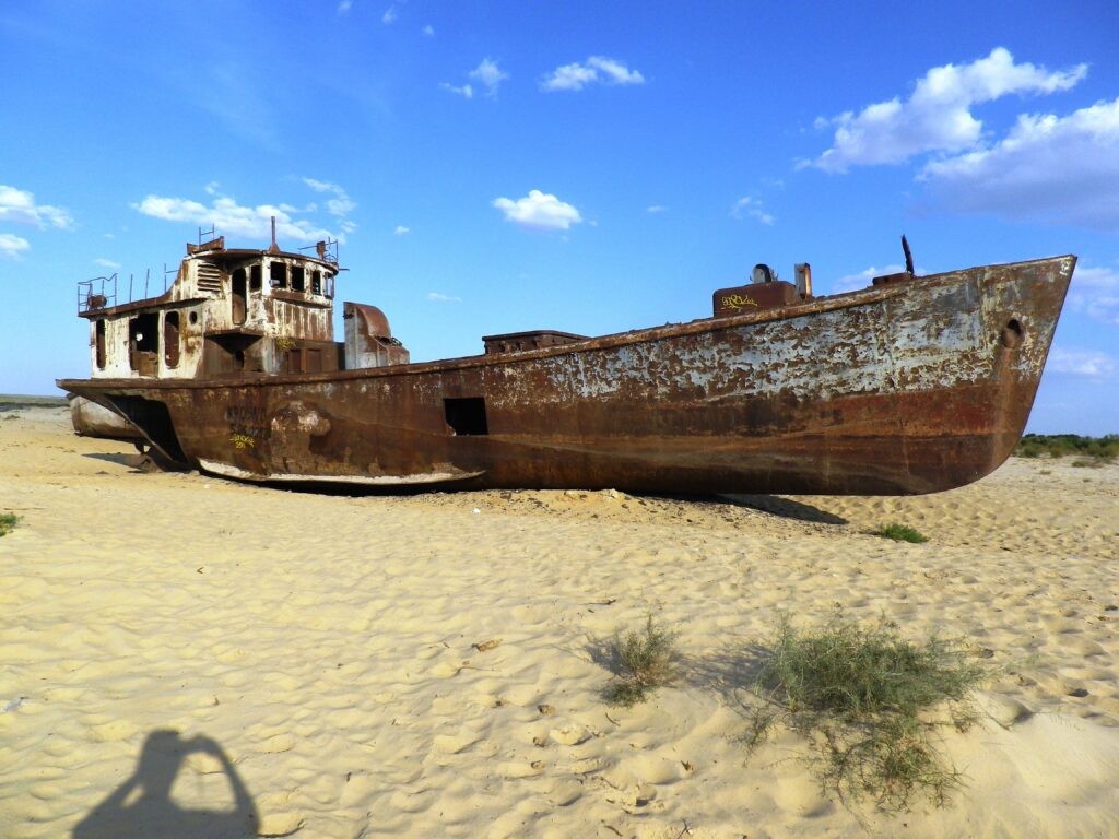
Thanks to cooperation between the Central Asian states, the ultimate demise of the Aral Sea has been prevented. This year, the Northern Aral Sea has significantly replenished its water reserves. The Northern portion of the Aral Sea has received 12.5 times more water this year than the previous year - up to 75 cubic meters per second, the Ministry of Water Resources and Irrigation of Kazakhstan stated in July. The Syr Darya River delivers 650 cubic meters of water per second to the Kyzylorda Oblast. "Joint work has been carried out with Uzbekistan and Kyrgyzstan. In particular, approved water supply schedules are being observed,” Minister of Water Resources and Irrigation, Nurzhan Nurzhigitov explained. Formerly the world's fourth-largest lake covering 68,000 km², the destruction of the Aral Sea first dates back as far as the U.S. Civil War, when, finding his supply of American cotton under threat, the Russian Tsar decided to use the sea’s tributaries to irrigate Central Asia and create his own cotton bowl. With 1.8 million liters of water needed for every bale of cotton, the water soon began to run out. From the 1960s onwards, the sea level began to decline rapidly due to water withdrawal from the main feeder rivers, the Amu Darya and Syr Darya. The local population was growing, and fields needed irrigating. In 1989, the sea split into the Northern (Small) and Southern (Large) Aral reservoirs. [caption id="attachment_21020" align="aligncenter" width="591"] The former port of Zhalanash, Kazakhstan; image: TCA, Stephen M. Bland[/caption] Since independence, the rate of shoaling and desertification have continued to increase. Up until the late-1990s, the land surrounding the Aral Sea was still cotton fields; but today, it’s largely an expanse of salinized grey emptiness. The desiccation of the landscape has led to vast toxic dust-storms that ravage around 1.5 million square kilometers. Spreading nitrates and carcinogens, these storms – visible from space – used to occur once every five years, but now strike ten times a year. By 2007, the Aral had shrunk to one-tenth its original size. In 2014, the eastern part of the Southern Lake dried up completely, and the sea's area reached a historical low of 7,297 km². Over half a century, the volume of water had decreased 30-fold, and the sea's salinity has risen sharply. Nevertheless, Kazakhstan still manages to preserve the remnants of the once colossal lake; the region's fisheries and farms continue, and rare species of birds still inhabit the lands surrounding the shoreline. Today, most scientists say restoring the Aral Sea completely is impossible, but Kazakhstan is attempting to preserve the Northern portion, sometimes referred to as the "Small Aral Sea." In 1993, the International Fund for Saving the Aral Sea (IFSAS) was established, which united Kazakhstan, Uzbekistan, Kyrgyzstan, Turkmenistan, and Tajikistan in this most challenging of tasks. At the time of IFSAS creation, the water area stood at approximately 36,000 km². Over the following decades, it continued to decline, and in 2001 Vozrozhdeniya (Renaissance) Island became connected to the mainland. Vozrozhdeniya contains...

Facing Pressures, Koytendag Nature Refuge in Turkmenistan Aims for UNESCO Status

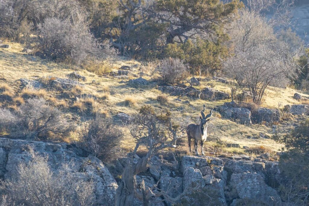
Limestone canyons and grassy plateaus. Vultures, lynx and  markhor, a wild goat known for its corkscrew-style horns. Pistachio trees and juniper forests. The fossilized footprints of dinosaurs and a cave that runs three kilometers into the ground.  The Koytendag State Nature Reserve and surrounding areas in eastern Turkmenistan are a stunning refuge of biodiversity next to Uzbekistan and near Afghanistan. The ecosystem includes river valley plains as well as Ayrybaba, Turkmenistan’s highest mountain at 3,137 meters. Some 50,000 people live in the area. Conservationists are assessing whether the region, which faces pressures such as agricultural encroachment, illegal hunting and unregulated tourism, can become a UNESCO natural world heritage site. [caption id="attachment_20918" align="aligncenter" width="551"] Researchers at the mouth of Koytendag’s Kaptarkhana cave (Image: CLLC)[/caption] There are efforts to reframe the bid for UNESCO status as a “transnational nomination” that pairs Koytendag with Uzbekistan’s adjoining Surkhan State Nature Reserve and could reduce barriers to the movement of wildlife between the two areas. The Koytendag reserve encompasses about 27,000 hectares and the total area of the proposed heritage space in Turkmenistan is 122,000 hectares, according to UNESCO. The U.N. agency says Koytendag is somewhat similar to other mountainous reserves in Central Asia - Chatkal in Uzbekistan, Aksu-Dzhabagly in Kazakhstan and Sary-Chelek in Kyrgyzstan – “but unlike them has a number of highly distinctive geological features.” Turkmenistan’s “system of protected areas,” which includes mountain, desert and marine ecosystems, covers 4.38% of the country, or just over 2,150,000 hectares, the Ministry of Environmental Protection said. Turkmen officials have been working with international conservation groups to protect and restore biodiversity. Conservation X Labs, or CXL, has outfitted some Turkmen rangers with new field uniforms, including those at Koytendag reserve, according to Tatjana Rosen, director of Central Asia Programs for the U.S.-based group.  [caption id="attachment_20920" align="aligncenter" width="533"] Panoramic view of the Koytendag reserve (Image: CLLC)[/caption] Rosen also said CXL and another group, the Center for Large Landscape Conservation, hired an international expert in SMART conservation technology and bought rugged Blackview phones where the SMART software is downloaded. Koytendag rangers have the devices and can use the technology to collect, analyze and report data from the field. Integrating the technology at the national level is ongoing.     Another international donor active at Koytendag is the Critical Ecosystem Partnership Fund, which has funded the conservation of pistachio orchards, the improvement of water supply, the education of local communities about the environment and other projects.   Last year, national and international conservationists conducted a weeklong field mission in Koytendag, surveying flora and fauna and also talking to local communities. At one point, the team chatted with shepherds tending their flocks about sustainable use of pastures and other employment options.    “Overall, it was noted that jobs are scarce in the villages and the demand for shepherding continues to increase,” the Center for Large Landscape Conservation said in a report on the trip.  A meeting of conservationists followed soon after in Ashgabat, Turkmenistan’s capital.  Speleologists have been interested in Koytendag's elaborate cave...

One Dead and Six Missing in Turkmenistan Mudslides

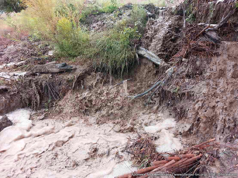
One soldier has been killed and six are missing during mudslides caused by recent heavy rains in Turkmenistan. It is being reported that the man died at the Serakhs border outpost in Akhal province. "On May 17, around 17:00 hours, seven soldiers from the 16-border outpost of the Border Troops connection in Serakhs [on the border with Iran] went missing. The body of one of them was found May 18. The searches for the other six soldiers continue," an anonymous source commented. "The search work is being carried out by the border troops' forces of the adjacent territories," the source said. Special means, such as drones or helicopters, are not involved in the search operations. The source adds that on the day of the incident, the soldiers were sent to repair the automobile roads next to the military unit, which were washed away by mud-flows. The Turkmen government is trying to stop information about the incident from being published, and "it is dangerous to ask and inquire about the details". But in conversations among themselves, servicemen are discussing that "sending soldiers in such weather to this area was a wrong decision and the cause of the accident was the negligence of the commanders and management of the border guard unit." "It was not possible to get comments on the disappearance of several soldiers and the death of at least one of them from the Turkmen authorities, including the aforementioned military unit," the source notes. For almost ten days, Turkmenistan’s capital Ashgabat has been flooded with rain, in what local meteorologists think have been the worst downpours since the 1970s. The rain has caused significant damage to the city’s infrastructure. The Akhal province has also been badly affected, with agricultural land flooded. Mud-flows hit the cities of Anev and Kahka, and in many areas electricity and part of the rail network were shut down. However, there have been no reports in Turkmen media about the rains and the damage they are causing.

Turkmenistan Bans People From Talking About the Weather

For almost ten days Turkmenistan's capital Ashgabat has been flooded with rain, in what local meteorologists think have been the worst downpours since the 1970s. The rain has caused significant damage to the city's infrastructure. The Akhal province has also been badly affected, with agricultural land flooded. Mudflows hit the cities of Anev and Kahka, and in many areas electricity and part of the rail network were shut down. However, there have been no reports in Turkmen media about the rains and the damage they are causing. Turkmenistan's law enforcement agencies have taken unprecedented measures to prevent photos and videos of the downpours from appearing on social networks. According to Radio Azatlyk, internet speed has slowed down, working VPNs are blocked, and IMO messenger has almost stopped working. A Turkmenabad police officer, who spoke on condition of anonymity, said of the order from above: "We have been ordered to prevent the leakage of defamatory photos and videos abroad. It was explained to us that if defamatory information gets into the hands of the West or the U.S. State Department, this information can be used to destabilize the domestic situation." The situation is the same in Ashgabat. Security services are identifying and taking to police stations citizens who have shared photos and videos on social media of the rains, and the damage caused by the rains in Ashgabat and the provinces. "In Ashgabat, cars could not move along the streets, people were swept away by the water pressure, and some of them were badly hurt. In the suburbs, houses and farms were flooded, farmers may be left without any income. There are many casualties, but there are no fatalities among the residents. Now the situation is gradually normalizing, and the authorities are eliminating the consequences of the flooding," one Ashgabat resident told The Times of Central Asia.

USAID Funds Improved Water Management in Turkmenistan

On 2 May the United States Agency for International Development (USAID) and the State Committee for Water Resources of Turkmenistan launched a new metering system to measure water flow on the Karakum River near Ashgabat. Financed with a grant from USAID Central Asia’s Regional Water and Vulnerable Environment Activity, the system offers a powerful means by which the country can sustain water availability and build climate resilience. As reported by the U.S. Embassy in Turkmenistan, by providing real-time data to the State Committee for Water Resources, the new system will enable a more efficient allocation of water to agriculture, households, and industry. The World Bank has forecast that because of climate change, the volume of water flowing from tributaries of the Amu Darya River into Turkmenistan could drop by 25% in July and August, and consequently could impact supplies of drinking water and water needed to produce wheat and cotton. Within this context, the new metering system will provide the invaluable information about flow rates and water withdrawals on the Karakum River and in turn, allow the government to advise farmers of the precise amount of water needed for crop growth.