Many residents of Almaty, Kazakhstan’s largest city, have known since childhood what to do in the event of an earthquake. Children are taught to stand near load-bearing walls or structural beams in their homes, as these areas are considered more resistant during tremors. Many households keep an emergency kit with water, food and blankets in an accessible place. Such precautions are not excessive: Almaty experiences regular seismic activity.
The latest significant tremor occurred on February 17, with an epicenter located 74 kilometers northeast of the city. The earthquake registered a magnitude of 5.0. City residents left their homes and offices and gathered outside, a familiar reaction in a city long accustomed to seismic risk.
National alert system
In May 2024, Almaty introduced the Mass Alert system to notify residents of emergencies, including earthquakes, floods, and man-made disasters. The system uses Cell Broadcast technology to send text notifications to all mobile subscribers within a specific geographic area, regardless of their mobile operator. Because messages are transmitted through cell towers rather than individual calls or messages, the system is designed to avoid overloading mobile networks during emergencies. It is integrated with 28 seismic stations.
Many experts say the system’s launch followed the January 2024 earthquake, which was felt across southern Kazakhstan. Almaty experienced several tremors measuring up to magnitude 5.0, triggering widespread panic. Traffic jams stretching for kilometers formed on roads leading out of the city. Forty-four people sought medical attention, most of them injured while attempting to exit buildings quickly.
Scientists warn that a powerful and destructive earthquake in the region is inevitable, although the timing cannot be predicted. Almaty is located in a zone rated at up to 10 points on the MSK-64 seismic intensity scale. Each year, up to 200 minor tremors are recorded within an 80-kilometer radius of the city. Earthquakes with magnitudes between 2.0 and 4.0 are considered typical. Approximately 30 tectonic faults run through the city and its surroundings, more than 60% of them in mountainous areas.
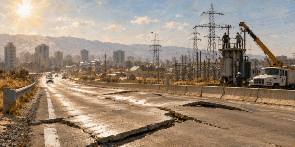
Experts estimate that, given current dense and high-rise construction, as many as 30% of buildings could be destroyed in the event of an earthquake measuring 9-10 points in intensity. During the Soviet period, buildings taller than nine stories were generally prohibited in the city. The notable exception was the 25-story Kazakhstan Hotel, which was constructed with seismic reinforcement measures.
Today, high-rise construction has expanded significantly, including in some of the city’s more seismically vulnerable foothill areas. The emergency warning system does not predict earthquakes in advance; it issues alerts only once tremors have already been detected. The system has been activated during several real seismic events.
Seismological predictions
In Kazakhstan, official forecasts are issued by the Institute of Seismology. At the same time, attempts at earthquake prediction have occasionally emerged outside the scientific mainstream. One of the most prominent figures associated with such efforts is biophysicist Viktor Inyushin. In the 1990s, he appeared in the media describing experiments aimed at predicting earthquakes by observing crushed peas, acorns, barley seeds, bacterial colonies, and fungal spores. In 2018, Inyushin forecast a strong earthquake in Almaty in 2019. The prediction was publicly rejected by professional seismologists and did not materialize.
History of destruction
Central Asia experienced several devastating earthquakes in the 20th century, some of which nearly destroyed entire cities.
In Kazakhstan, the most powerful earthquake in more than a century is widely considered to be the 1911 Kemin earthquake, named after the river near its epicenter. It struck on January 4, 1911, at 4:25 a.m. The intensity at the epicenter reached 10-11 points, and its magnitude is estimated at 8.2. Hundreds of buildings were destroyed in Verny, as Almaty was then known, and many people were killed. Sub-zero temperatures worsened conditions for survivors. The main shock lasted about five minutes, an unusually long duration, and strong aftershocks continued for years.
A devastating earthquake struck Ashgabat, the capital of Turkmenistan, on the night of October 5-6, 1948. The magnitude was 7.3, with the epicenter located at a depth of 18 kilometers, almost directly beneath the city. Approximately 8,800 people were evacuated to other parts of the Soviet Union. Due to strict Soviet-era secrecy, the exact death toll remains uncertain. Some sources estimate between 25,000 and 27,000 fatalities.
Another major earthquake occurred in Tashkent, the capital of Uzbekistan, on April 26, 1966, at 5:23 a.m. Although the magnitude at the epicenter was 5.2, the intensity exceeded 8 points locally. Official figures reported eight deaths, but more than 300,000 people were left homeless. Families were relocated to other Soviet republics, and large-scale reconstruction efforts were undertaken.
According to scientists, seismic activity in Central Asia is linked to the ongoing formation of the relatively young Tien Shan mountain range. As tectonic processes continue, the region is expected to remain vulnerable to earthquakes for the foreseeable future.