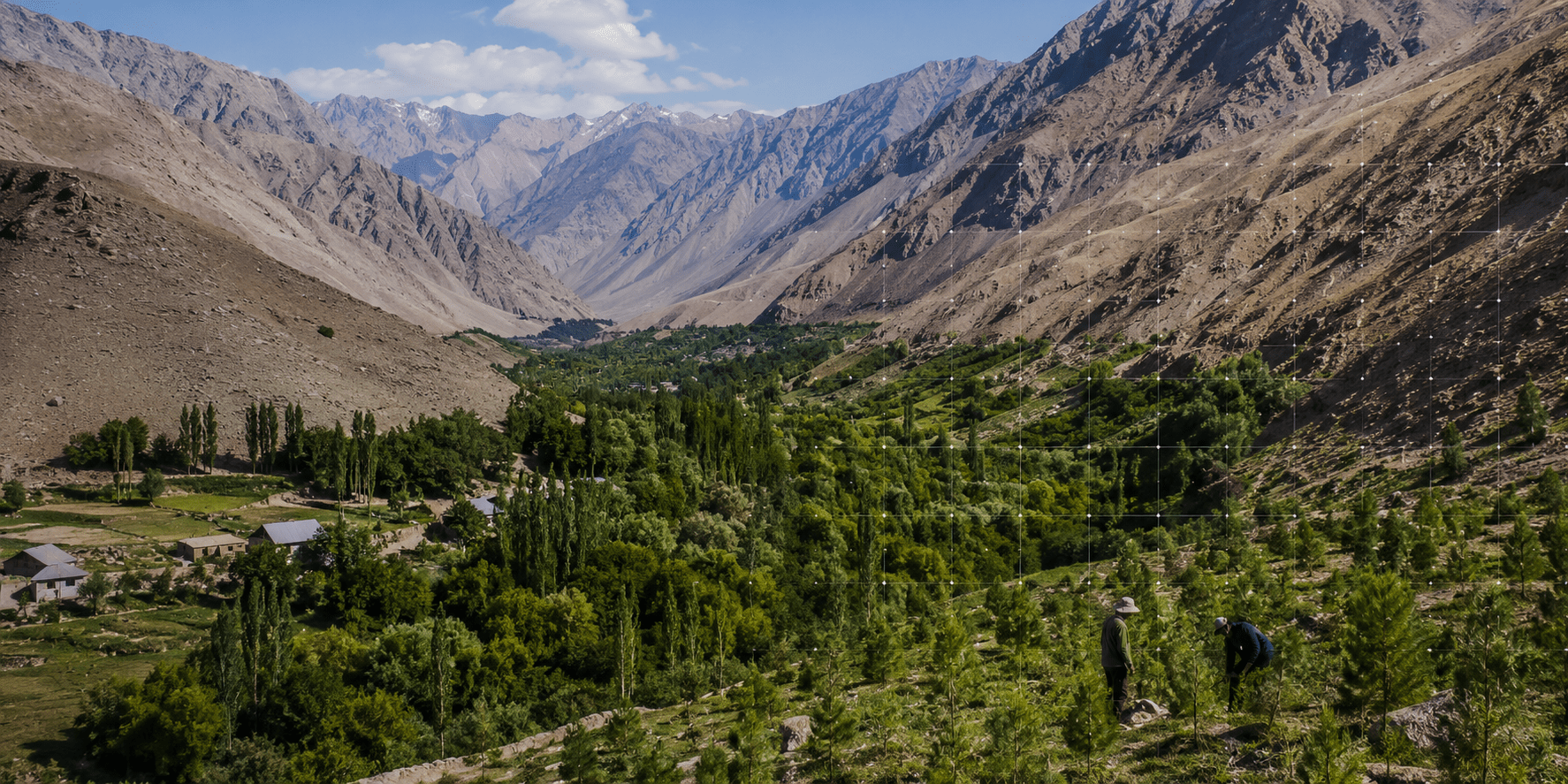
In Barvoz village in the Western Pamirs, Zarifkhon Gulchinov watched a green forest near his home become a semi-desert during the 1990s. The collapse of the Soviet Union and Tajikistan’s civil war left the isolated region short of electricity and coal. Families cut trees to heat their homes and cook.
“I also went to the forest for firewood, but I cut down only old and dry trees and bushes,” Gulchinov recalled. He later joined a community forestry program and received five hectares of degraded land to restore. Villagers now plant hundreds of trees and protect young growth from livestock. They also maintain an irrigation canal fed by mountain water.
Such places explain why a forest inventory is more than a technical count. A strip of trees can supply fuel or hay. It can also hold a riverbank together and shield fields from erosion. Yet Tajikistan has spent decades without a reliable national picture of where its forests remain or what condition they are in.
Counting What the Country Has
On July 15, Deputy Forestry Agency Director Davlatali Sharifzoda announced a national inventory using satellite images and field inspections. The work will cover forests under every form of ownership, and its results will support ten-year management plans for each state forestry enterprise.
Local coverage has described the exercise as Tajikistan’s first complete forest inventory using satellite data. A World Bank project appraisal says the country last conducted a national inventory in 1990. The current exercise is therefore the first nationwide inventory since independence and the first to use modern mapping methods across the country.
The inventory combines Sentinel-2 and RapidEye images with geographic information systems. Machine-learning tools classify forest types, while mobile laser scanners can create three-dimensional models of tree stands. Field teams will still visit selected plots to measure tree diameter and height, and count the number of trees in each area. Their observations will show whether the satellite classifications match conditions on the ground.
The work is being carried out by Aerogeodesy Dushanbe and Austria’s Umweltdaten GmbH through the World Bank-backed Tajikistan Resilient Landscape Restoration Project. A June progress update said the team carrying out the inventory had been appointed and work was underway. The project is due to close on September 30, 2027.
Why the Numbers Diverge
Tajikistan has long been described as one of Central Asia’s least forested countries. The figure most often used is about 3% of the national territory, or roughly 420,000 hectares. The World Bank has also noted that land administered by the Forestry Agency covers a much larger area, but much of that land is pasture rather than forest.
Preliminary satellite work has now put forest cover at about 4.7%. The higher estimate does not mean that Tajikistan suddenly gained trees. Better mapping may be capturing sparse woodland and remote areas missed by older records. The final inventory should also separate actual forest cover from land that belongs to the state forest fund but carries little or no tree cover.
That distinction affects budgets and restoration targets, shaping land-use decisions and affecting people. The Forestry Agency says 43,082.5 hectares have been returned to the state forest fund, including more than 1,000 hectares during the first half of 2026. Some plots had been used by dehkan farms and private individuals. Court proceedings continue over land in the Khovaling and Muminabad districts.
Land returned to the forest fund may still be bare or degraded. The agency says it will be restored and replanted, with added protection for the most vulnerable areas. Accurate maps will establish a baseline and show whether new growth takes hold.
Forests People Use
Tajikistan’s forests include juniper on mountain slopes and floodplain woodland beside rivers. Pistachio, walnut, and saxaul also grow in different parts of the country. The Forestry Agency says pistachio forests alone cover more than 80,000 hectares, mostly in the south.
These forests remain under pressure: livestock can eat seedlings before they mature, dry conditions raise the risk of fire, while insects and disease damage weakened trees. TCA previously reported that some fire sites were beyond the reach of vehicles. “There are no roads, equipment cannot reach the area, and the material and technical base is poorly developed,” Sharifzoda said.
Community management offers one option to reduce that pressure. Under Joint Forest Management, residents can receive long-term rights to restore and use forest plots under plans agreed with state forestry enterprises. In the Sarazm community near Panjakent, 20 tenants restored about 20 hectares along the Zeravshan River. One tenant, Khandamir Khujamerov, planted more than 500 trees on 4.3 hectares, fencing the plot against grazing cattle.
“Joint Forest Management has motivated me and many of my neighbours to rehabilitate our forests,” Khujamerov said. A national inventory can give such local agreements a clearer baseline, identifying degraded land and tracking recovery. It can also guide forestry staff toward areas where limited resources can do the most good.
From Map to Management
By June 1, the Forestry Agency said forest creation and restoration work had covered 3,298.3 hectares in 2026. Separate work had supported natural regrowth and maintained established forest areas.
Tajikistan has pledged to restore 66,000 hectares of degraded land by 2030. Reliable baseline data will help assess project-specific promises. The Rogun compensation plan, for example, calls for 786 hectares of forest restoration after construction affects 262 hectares of forest and floodplain habitat.
The inventory cannot restore a hillside by itself, but it can end years of planning based on old maps and broad estimates. In Barvoz, the change is already visible in fenced plots and returning vegetation. The national map should show whether such recovery remains isolated or is spreading across Tajikistan.